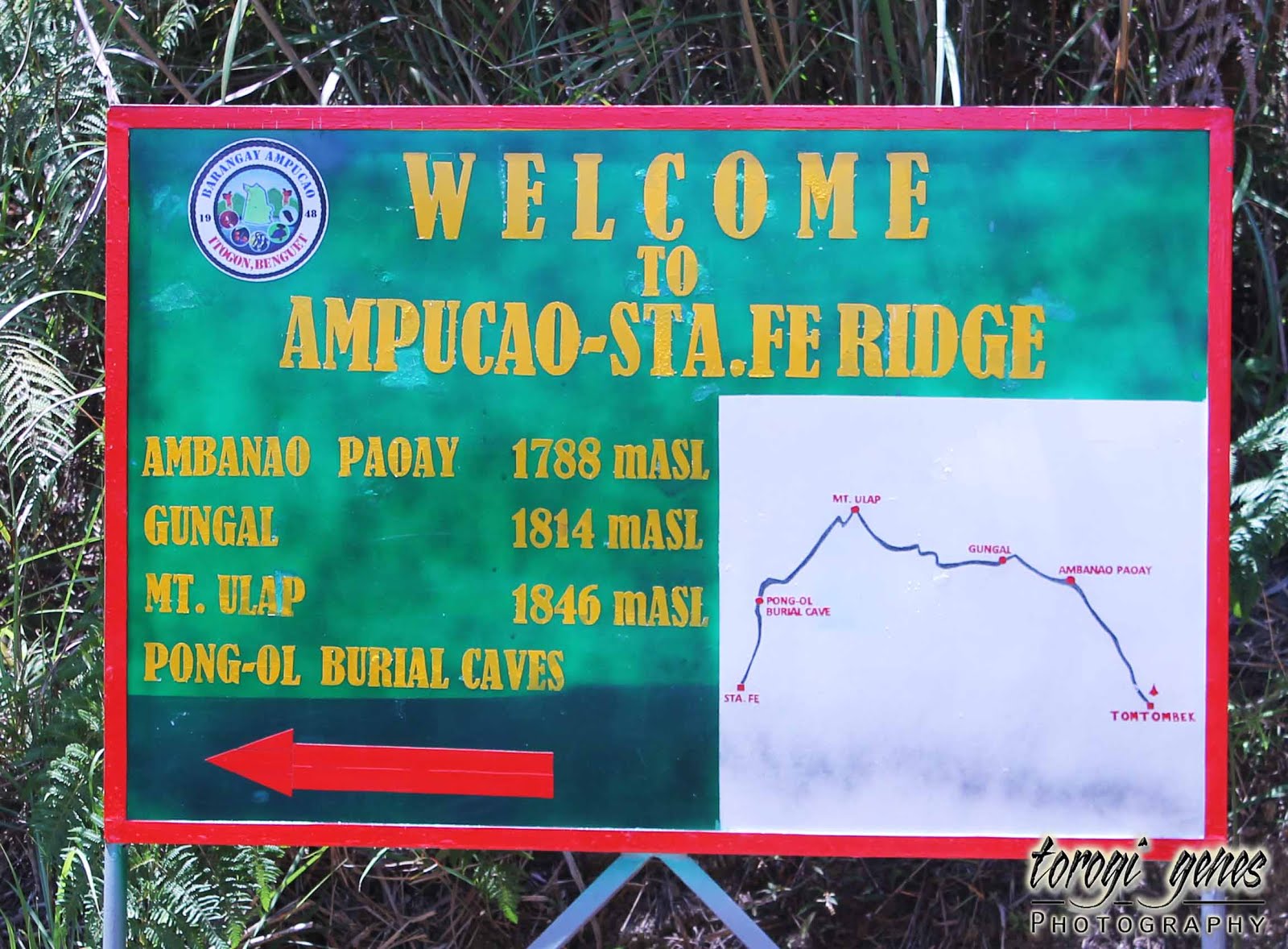
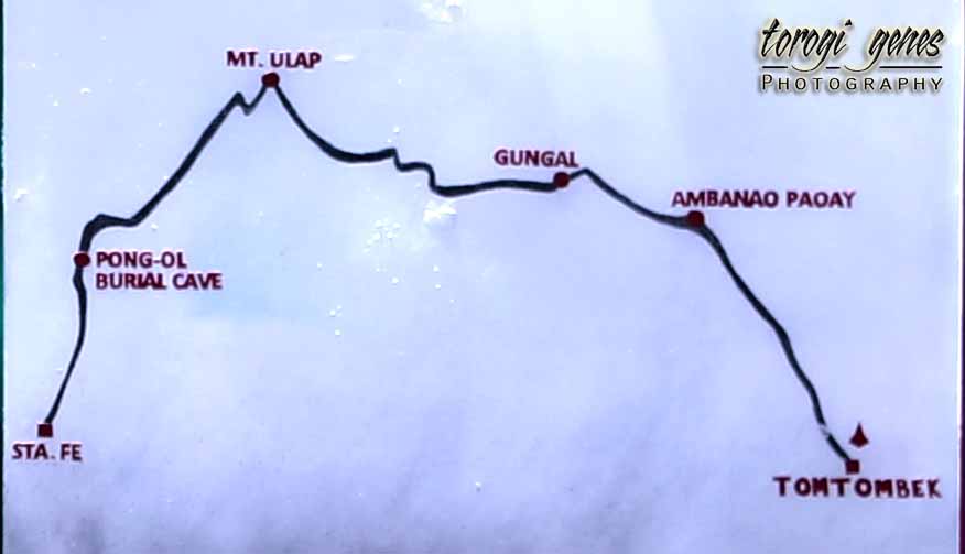
BenCab Museum

BenCab Museum

BenCab Museum, located in Tuba, Benguet, showcases the works of Benedicto Reyes Cabrera and other artists, different galleries, exhibitions, and has an outside farm and garden. This house of art is the most popular museum nearest Baguio City.

Location

Address: Km. 6 Asin Road, Tadiangan, Tuba, Benguet, Philippines

Coordinates: 16.4107° N, 120.5504° E

Map


Business Hours
  • Tuesdays to Sundays 9:00am to 6:00pm (last entry at 5:30pm)
  • Closed Mondays, Christmas day and New Year’s day

How to Get There
  • Take a jeepney bound to Asin Road for a meager amount.
  • You can hail a taxi but for a more expensive fare.
  • Driving your own car is possible. Just follow available satellite navigators.

Contact Details

Tel/Fax: (+63 74) 442 7165

Web Page: http://www.bencabmuseum.org

Email: bencabartfoundation@gmail.com


BenCab Museum, located in Tuba, Benguet, showcases the works of Benedicto Reyes Cabrera and other artists, different galleries, exhibitions, and has an outside farm and garden. This house of art is the most popular museum nearest Baguio City.

The BenCab Museum, a 15-minute drive away from Baguio City, houses the works of Benedicto Reyes Cabrera, a conferred National Artist for Visual Arts. Contrary to the common notion, it is located in Tuba, Benguet, a neighboring municipality of Baguio City. Also, the BenCab Museum houses the permanent collection of Philippine National Artist Benedicto Reyes Cabrera in several galleries (1).

Like other private museum, it also has an admission fee. General admission costs Php150.00 while students, PWD and senior citizens need to pay Php100.00 after discount, provided that they present a valid ID (school ID, PWD card, senior citizen ID). They also have special rates for organized group tours with minimum of 30 pax. Outside the museum, guest can also have an Eco-trail tour.

Some of my favorites are depicted in the following images.


Reception area of the museum.

Cafe Sabel is located at the lowest level of the building.

The museum offers the following parts:

  • BenCab Gallery
  • Erotica Gallery
  • Larawan Hall
  • Cordillera Gallery
  • Galleri Indigo
  • Edison T. Coseteng Patio
  • Philippine Contemporary Art Gallery 1 & 2
  • Sepia Gallery
  • Bulol Installation
  • Maestro Gallery
  • Pation Salvador
  • Graffiti Wall

Other notable tourist spot in Tuba includes Aran Cave, Asin Hot Springs, Cafe in the Sky, and Hydro Falls.

References

(1) Museum and Galleries (n.d.). In BenCab Museum website. Retrieved from http://www.bencabmuseum.org/museum-galleries/

(2) Figure of a Male Rice Deity (Bulul) 19th century or earlier (n.d.). In The Met 150 website. Retrieved from https://www.metmuseum.org/art/collection/search/626371

Advertisement

Tekip Falls, Bakun, Benguet

Tekip Falls, a towering natural beauty located in Poblacion, Bakun, Benguet, is probably the most known waterfalls in the municipality as well as the most accessible one.

Tekip falls might be the most popular waterfall in Bakun. This is probably related to easy access from Poblacion. It would only need more or less 15 minute-easy-walk from the community, making it the most accessible among the major falls in the area.

En route, you will be amazed with the scenic view of the community area as well see one of the highest footbridge in the community.

On your way to Tekip Falls, you can see a wider view of the community with Mt. Kabunian as the backdrop.
Walking through this hanging bridge near Tekip falls will probably make you dizzy because of its height and length.

Behold the soaring heights of Tekip Falls! Standing at the base of the waterfall, you will feel that you are easily dwarfed by the fall’s immense height. Take note, however, that the best time [like other waterfalls] to see this spectacle is during rainy season where the volume is at its peak.

The beauty of Tekip Falls depends heavily on the volume of rain drops. The image above was taken on May where rainy season is still starting. Actually, it did not rain for days before we visited the site.

Images below detail the different parts of Tekip Falls. Again, the more volume of water, the better. Images below depicts a time when the place did not have voluminous rain in the past days.

Tekip Falls have multiple water streams and cascades. Rainy season has the best view of this natural spectacle.

Other Notable Waterfalls and Destinations in the Area

Where to Stay in Bakun

  • Option 1. Old Municipal Hall at Php80.00 per night per person. Pro: cheap. Cons: bring your own sleeping gears; food** not included.
  • Option 2. Sagunday Transient at Php200.00 per night per person. Pros: you get to sleep in a bed with foam, bedding, CR, and with kitchen and cooking utensils (yes, you can cook and stores are a stone’s throw away. Con: food** not included.

** You can arrange with the barangay officials to cook for you at around Php200.00.

Contact Persons

  • Mr. Arthur Tolito (Municipal Tourism Officer): +63 921 211 3687
  • Ms. Nenita Budas (BTC President): +63 918 352 3722

Expenses (food not included) as of May 2019

  • Baguio City to Km. 5, La Trinidad: Php10.00
  • Bus fare from La Trinidad to Bakun: Php180.00
  • Accommodation: Php80.00-200.00
  • Environmental fee: Php50.00
  • Guide fee (Per guide per group [max of 6 pax per group]. In excess of 6 members, additional heads will pay Php75.00 each. However, if the total participants are beyond 8, it is mandatory to have two guides. Further, in excess of the maximum hours, the guide will be paid additional Php50.00 per hour):
    • Tekip falls: Php300.00 (3 hours)
  • There are also packages if you want to go to more than one waterfalls and/or site (valid for a day, unless specified):
    1. Tekip falls, Bagiw river, Pikaw falls, rice terraces: Php1000.00
    2. Tekip falls, Bagiw river, rice terraces: Php600.00
    3. Mangta, Pattan, and Tekip falls: Php1300.00
    4. Mangta, Pattan, Pikaw and Tekip falls: Php1600.00

Can’t get enough of Bakun waterfalls? Visit the following page for more information on other waterfall packages:

OF WATERFALLS AND FOOT BRIDGES: THE CHASE IS ON IN BAKUN

Reminders

  • Always practice the LNT principles.
  • Be early taking jeep from Baguio City to La Trinidad as traffic might get heavy.
  • Get in touch with the contact persons listed above for to verify for any changes in transportation schedules, fees, temporary closure of sites, etc. This will also give them ample time to prepare for your accommodation.
  • Be courteous to the locals, tourism and local guidelines, the culture, and of the place itself.

Pikaw Falls, Bakun, Benguet

Pikaw Falls, located in Poblacion, Bakun, Benguet, is one of the major falls in the municipality due to its towering height and rainbow formation.

The route to Pikaw falls converges with part of the path going to Gedgedayan, another tourist hill destination. Going to Pikaw is an enjoyable journey itself as you will see a lot of beautiful sceneries, rice terraces, water cascades, mini waterfalls, burial cave, as well as pass through several hanging bridges.

As of writing, access to Pikaw Falls is a little bit of a challenge. Previously, the locals had created pathway for tourists bound to the area. However, it was destroyed during one of the previous typhoons. Apparently, tourists were discouraged to go there because of this, despite of the beauty of the place. Fortunately, we were able to convince our guide, Uncle Max, to accompany us. I had to admit that going there is grueling as, obviously, the old path was already covered with vegetation. I had to admire Uncle Max’s diligence to bring us there.

Our tour guide Uncle Max, the guy in blue in the lead, had to clear our way because no tourist had reached Pikaw Falls for a couple of years. The above image is actually the easiest part. Some parts hard which needs you to stoop walk under brushes and walk through cliff. Once a new safe path will be created, it would be a lot easier to go there again.

Unlike other major falls in Bakun, Pikaw Falls retains enough volume of water to maintain a reasonable view even during summer days. During rainy months, the volume of water makes even the falls more beautiful and sometimes changes its clear water to chocolate-like color during heavy downpour.

During heavy rains, Pikaw falls turns into a chocolate-colored waterfall. This is due to the soil carried by small bodies of water coming from the bulldozed road above.

The name of the falls is taken from a plant which abundantly grows in the site. The plant is Pikaw, a plant typically growing in rivers, streams, falls, and marshes in the Philippines and in neighboring countries. Its scientific name is Schismatoglottis calyptrata (Bodner & Gereau, 1988) and is a kind of a wild taro used for indigenous dishes.

Pikaw, a wild taro, commonly grows in steep and rocky portions of bodies of water. The abundance of this plant in Pikaw Falls prompted the locals to call it as such.

Pikaw Falls has four stream drops from its overhung collapse. The water drops to boulders of stones instead of a plunge pool unlike in Mangta Falls. The way to the falls might be arduous, but the beauty of the destination easily erases your curses on the way.

Pikaw Falls as seen from a mountainside on the way. At this vantage, you can see the two levels of the falls.
Scaling the boulders for a better view of the falls is a little bit tricky. You need to squeeze through a space in between big rocks then scale the slippery boulders.
These are two of the towering water streams.
The other water streams are are more of a cascade over a wall of rock.
Yup, you can see a small rainbow up close in Pikaw Falls.

The presence of billions of droplets from the impact of water on the stone base of the falls creates a rainbow downstream. This phenomenon, like is Pattan Falls, is common in big waterfalls where the rays of the sun reaches the area where droplets are constantly numerous.

The following videos show Pikaw Falls in its towering splendor and the rainbow formation.

Pikaw falls as seen from a high vantage point. In here, you will see the upper level (waterfalls) draining to the lower level (cascade).
If you can’t get over the rainbow in this waterfall, this video will show you how vast the droplets are which is necessary in the formation the rainbow.

Other Notable Waterfalls and Destinations in the Area

Where to Stay in Bakun

  • Option 1. Old Municipal Hall at Php80.00 per night per person. Pro: cheap. Cons: bring your own sleeping gears; food** not included.
  • Option 2. Sagunday Transient at Php200.00 per night per person. Pros: you get to sleep in a bed with foam, bedding, CR, and with kitchen and cooking utensils (yes, you can cook and stores are a stone’s throw away. Con: food** not included.

** You can arrange with the barangay officials to cook for you at around Php200.00.

Contact Persons

  • Mr. Arthur Tolito (Municipal Tourism Officer): +63 921 211 3687
  • Ms. Nenita Budas (BTC President): +63 918 352 3722

Expenses (food not included) as of May 2019

  • Baguio City to Km. 5, La Trinidad: Php10.00
  • Bus fare from La Trinidad to Bakun: Php180.00
  • Accommodation: Php80.00-200.00
  • Environmental fee: Php75.00
  • Guide fee (Per guide per group [max of 6 pax per group]. In excess of 6 members, additional heads will pay Php75.00 each. However, if the total participants are beyond 8, it is mandatory to have two guides. Further, in excess of the maximum hours, the guide will be paid additional Php50.00 per hour):
    • Pikaw falls: Php500.00 (5 hours)
  • There are also packages if you want to go to more than one waterfalls and/or site (valid for a day, unless specified):
    1. Tekip falls, Bagiw river, Pikaw falls, rice terraces: Php1000.00
    2. Mt. Gedgedayan + Pikaw falls, Bagiw river: Php1200.00
    3. Pikaw falls + Bagiw river: Php600.00 (valid for 6 hours)
    4. Mangta, Pattan, Pikaw and Tekip falls: Php1600.00

Can’t get enough of Bakun waterfalls? Visit the following page for more information on other waterfall packages:

OF WATERFALLS AND FOOT BRIDGES: THE CHASE IS ON IN BAKUN

Reminders

  • Always practice the LNT principles.
  • Be early taking jeep from Baguio City to La Trinidad as traffic might get heavy.
  • Get in touch with the contact persons listed above for to verify for any changes in transportation schedules, fees, temporary closure of sites, etc. This will also give them ample time to prepare for your accommodation.
  • Be courteous to the locals, tourism and local guidelines, the culture, and of the place itself.
  • Do not go there if you don’t have endurance for challenging routes.

Reference

Bodner, C. C. & Gereau, R. E. (1988). A contribution to Bontoc ethnobotany. Economic Botany, 42(3): 307-369. Retrieved on 02 August 2019 from https://www.jstor.org/stable/4255087?seq=1#page_scan_tab_contents.

Pattan Falls, Bakun, Benguet

Pattan Falls, located in Poblacion, Bakun, Benguet, is one of the major falls in the municipality due to its towering height and proximity to Mt. Kabunian.

Bakun, Benguet was initially known to tourist of its beautiful mountains. Lately, the waterfalls of this wonderful place is also gaining attention. Of the major falls, Pattan seems to have found a place in hiker’s itinerary primarily due to its proximity to Mt. Kabunian.

Pattan Falls, located in Poblacion, Bakun, Benguet, is one of the major falls in the municipality due to its towering height and proximity to Mt. Kabunian.

Unlike other waterfalls, Pattan falls has a couple of interesting points to offer. One, the height of the waterfall is towering and is approximately 150 meters, according to Uncle Max, one of the pillars of tour guiding in Bakun. This makes the sound of the water fall so loud that you can hear it several meters away even before having a glimpse of it.

Pattan Falls, located in Poblacion, Bakun, Benguet, is one of the major falls in the municipality due to its towering height and proximity to Mt. Kabunian.
Water from Pattan Falls drops from the precipice above to approximately 150 meters below.

Two, it generates an amazing RAINBOW! Yup, rainbow guys. So, if you are still trying to get that pot of gold at the end of the rainbow, this is one of the right places to be.

The rainbow appears if the base of the falls is under the sun. Moreover, the best angle where to take a picture of the rainbow depends on the volume of the water and the position of the sun.
Pattan Falls, located in Poblacion, Bakun, Benguet, is one of the major falls in the municipality due to its towering height and proximity to Mt. Kabunian.
The impact of the water dropping to the base of the falls creates a multitude of droplets which is necessary fro rainbow formation when sunlight passes [reflects] through.

The images below show the whole length and levels of Pattan Falls as seen from Mangta Falls.

The video below shows Pattan Falls in its towering splendor.

Other Notable Waterfalls in the Area

Where to Stay in Bakun

  • Option 1. Old Municipal Hall at Php80.00 per night per person. Pro: cheap. Cons: bring your own sleeping gears; food** not included.
  • Option 2. Sagunday Transient at Php200.00 per night per person. Pros: you get to sleep in a bed with foam, bedding, CR, and with kitchen and cooking utensils (yes, you can cook and stores are a stone’s throw away. Con: food** not included.

** You can arrange with the barangay officials to cook for you at around Php200.00.

Contact Persons

  • Mr. Arthur Tolito (Municipal Tourism Officer): +63 921 211 3687
  • Ms. Nenita Budas (BTC President): +63 918 352 3722

Expenses (food not included) as of May 2019

  • Baguio City to Km. 5, La Trinidad: Php10.00
  • Bus fare from La Trinidad to Bakun: Php180.00
  • Accommodation: Php80.00-200.00
  • Environmental fee: Php75.00 per person
  • Guide fee (Per guide per group [max of 6 pax per group]. In excess of 6 members, additional heads will pay Php75.00 each. However, if the total participants are beyond 8, it is mandatory to have two guides. Further, in excess of the maximum hours, the guide will be paid additional Php50.00 per hour):
    • Php600.00 (6 hours)
  • There are also packages if you want to go to more than one waterfalls and/or site with Mangta Falls (valid for a day, unless specified):
    1. Mangta and Pattan falls: Php1000.00
    2. Mangta, Pattan, and Tekip falls: Php1300.00
    3. Mangta, Pattan, Pikaw and Tekip falls: Php1600.00

Can’t get enough of Bakun waterfalls? Visit the following page for more information on other waterfall packages:

OF WATERFALLS AND FOOT BRIDGES: THE CHASE IS ON IN BAKUN

Reminders

  • Always practice the LNT principles.
  • Be early taking jeep from Baguio City to La Trinidad as traffic might get heavy.
  • Get in touch with the contact persons listed above for to verify for any changes in transportation schedules, fees, temporary closure of sites, etc. This will also give them ample time to prepare for your accommodation.
  • Be courteous to the locals, tourism and local guidelines, the culture, and of the place itself.
  • Do not dare the pool if you do not know how to swim.

Mangta Falls, Bakun, Benguet

Mangta Falls, located in Poblacion, Bakun, Benguet, is now drawing tourists’ attention among its former waterfalls competitors in the area because of its breathtaking beauty and natural plunge pool.

When waterfalls started to become part of hiking itineraries in Bakun, Mangta Falls is commonly not included. Unlike Pattan Falls, its remoteness from mountain hiking paths could be a big factor. In fact, the previous local tourism guideline only includes Mangta Falls in one tour package but not as an stand-alone destination. Fortunately, as of early 2019, this now has been remedied and Mangta Falls is now part of other packages and can also be visited as a single destination.

The Path to Mangta Falls

Going to Mangta Falls maybe arduous but has more rewards than your sheets of sweat. The chirping of birds, wild mushrooms, and mountain scenes are but some of the things that will divert your attention from your sore muscles.


You’ll also get to walk on foot bridges other than the typical one. This includes stairs over a giant waterpipe, stairs over gigantic hydro pipes, or just walk over these pipelines.

The Magnificent Mangta Waterfall

The waterfall is one of the major attraction of Mangta Falls. It is approxiamtely 20 meters high from the top until it drops in the natural pool. Unlike other falls that you can climb up to some extent, water falls through a steep wall that scaling it is impossible without necessary equipment. Instead, better take dip, swim or dive in its pool. Relieve your sore muscles in the clean and icy water.

The following images shows Mangta Falls in different angles.

Mangta Falls, located in Poblacion, Bakun, Benguet, is now drawing tourists' attention among its former waterfalls competitors in the area because of its breathtaking beauty and natural plunge pool.

Mangta Falls, located in Poblacion, Bakun, Benguet, is now drawing tourists' attention among its former waterfalls competitors in the area because of its breathtaking beauty and natural plunge pool.

To appreciate the beauty of Mangta Falls, the following videos captured the cascading of water until it plunges to the natural pool below.

The video depicts a close up view of the falls and of the pool.
Mangtan Falls is a beautiful waterfall with a natural pool. Also, you can have a good view of the total length of Pattan Falls.

The Mangta Pool

Mangta Falls is very unique from the other waterfalls in Bakun because of its plunge pool. The natural pool is approximately 12 feet deep and as wide as a single volleyball court. This is more than wide enough for tourists who wants to swim its clear waters.

The pool drains to a pipeline which draws water for the nearby Aboitiz hydroplant. Don’t get scare of getting swallowed by the gigantic pipe because it is located on the far right side of the pool and has safety bars across pipe mouth. Actually, be more scared of the chilly water if you want to take a dip.

Tourists can take a dip and swim in the pool of Mangta Falls. The water is clean and refreshingly cold.

Other Notable Waterfalls in Bakun

Where to Stay in Bakun

  • Option 1. Old Municipal Hall at Php80.00 per night per person. Pro: cheap. Cons: bring your own sleeping gears; food** not included.
  • Option 2. Sagunday Transient at Php200.00 per night per person. Pros: you get to sleep in a bed with foam, bedding, CR, and with kitchen and cooking utensils (yes, you can cook and stores are a stone’s throw away. Con: food** not included.

** You can arrange with the barangay officials to cook for you at around Php200.00.

Contact Persons

  • Mr. Arthur Tolito (Municipal Tourism Officer): +63 921 211 3687
  • Ms. Nenita Budas (BTC President): +63 918 352 3722

Expenses (food not included) as of May 2019

  • Baguio City to Km. 5, La Trinidad: Php10.00
  • Bus fare from La Trinidad to Bakun: Php180.00
  • Accommodation: Php80.00-200.00
  • Environmental fee: Php75.00 per person
  • Guide fee (Per guide per group [max of 6 pax per group]. In excess of 6 members, additional heads will pay Php75.00 each. However, if the total participants are beyond 8, it is mandatory to have two guides. Further, in excess of the maximum hours, the guide will be paid additional Php50.00 per hour):
    • Php700.00 (7 hours)
  • There are also packages if you want to go to more than one waterfalls and/or site with Mangta Falls (valid for a day, unless specified):
    1. Mangta and Pattan falls: Php1000.00
    2. Mangta, Pattan, and Tekip falls: Php1300.00
    3. Mangta, Pattan, Pikaw and Tekip falls: Php1600.00

Can’t get enough of Bakun waterfalls? Visit the following page for more information on other waterfall packages:

OF WATERFALLS AND FOOT BRIDGES: THE CHASE IS ON IN BAKUN

Reminders

  • Always practice the LNT principles.
  • Be early taking jeep from Baguio City to La Trinidad as traffic might get heavy.
  • Get in touch with the contact persons listed above for to verify for any changes in transportation schedules, fees, temporary closure of sites, etc. This will also give them ample time to prepare for your accommodation.
  • Be courteous to the locals, tourism and local guidelines, the culture, and of the place itself.
  • Do not dare the pool if you do not know how to swim.

Of Bakun Waterfalls and Foot Bridges: The Chase is On

Bakun is one of the most picturesque municipality in the Cordilleras, if not in the country, as it boasts nature at its best. The place is known for its mountains, especially the trio of Mounts Tenglawan, Lobo, and Kabunian. Now, it also attracts tourists’ attention for its scenic waterfalls.

How to Get To Bakun, Benguet (DIY)

The best way to get to Bakun and experience the rush of its waterfalls is through Baguio City. From Baguio City, take a jeepney going to La Trinidad, Benguet and drop at the Caltex Gasoline Station at Km. 5. Take note that this is across Mercury Drugstore and NOT the one in Puguis junction or in front of Benguet State University. There is only one daily bus trip stationed there and starts moving between 6:00AM to 6:30AM. Be there at 6:00AM so that you will not miss it.

Contact Persons

  • Mr. Arthur Tolito (Municipal Tourism Officer): +63 921 211 3687
  • Ms. Nenita Budas (BTC President): +63 918 352 3722

Chasing Waterfalls in Bakun, Benguet

Bakun offers waterfalls of great heights and of incomparable beauty. Among the numerous waterfalls in the municipality, Mangta, Tekip, Pikaw, Pattan, Sakup, and Tres Marias are the most popular. Each have their own allure, depending on the height and width of the waterfall, presence of plunge pool, accessibility, and others.

Mangta Falls
Mangta Falls has a curtain like falls and a wide and deep plunge pool for swimming.

Want to see the details of the waterfall and plunge pool of Mangta Falls? Check it here:

MANGTA FALLS, BAKUN, BENGUET

Pattan Falls
Pattan Falls, with its impressive height and rainbow formation, is quite popular to hikers traversing the Bakun Trio because of its proximity to Mt. Kabunian.

Want to see the details of the waterfall and plunge pool of Pattan Falls? Check it here:

PATTAN FALLS, BAKUN, BENGUET

Pikaw Falls
Pikaw Falls, one of the farthest falls from Poblacion and hardest to reach, offers mist-forming plunges, rainbows, and unique boulders instead of a pool.

Want to see the details of the waterfall and plunge pool of Pikaw Falls? Check it here:

PIKAW FALLS, BAKUN, BENGUET

Sakup Falls
The Sakup Falls is only seen from afar as it is not yet open for tourism due to lack of safe access paths.
Tekip Falls
Tekip Falls might be the most popular among Bakun waterfalls. Probably, this is because of its proximity to Poblacion, easy to access, height of the falls, and picturesque facade.

Want to see the details of the waterfall and plunge pool of Tekip Falls? Check it here:

TEKIP FALLS, BAKUN, BENGUET

Tres Marias Falls
Tres Marias Falls (also known as Dalingaoan Falls) is a series of three falls in Sinacbat, Bakun. This thee-layered waterfalls can be seen in its totality en route to Tekip Falls.

Of Foot Bridges Over Crystal Clear Waters

Traversing Bakun’s heavy-trodden paths will almost always lead you to a foot bridge. In each waterfall destination, you will almost always pass through these hanging bridges. It may seem challenging to those who fear height but it surely does bring excitement walking through each of them.

This type of hanging bridge is the most common among foot bridges in Bakun. The above image is located near a burial cave.

The above image depicts a bridge over one of the gargantuan pipelines of Aboitiz hydroplant.

The nearest foot bridge in Poblacion is located near Tekip Falls.

Walking through a hanging bridge in Bakun could be challenging to some tourist who have fear of heights. However, this could also be an extraordinary experience to some.

Scenic Bakun

Going to Bakun will not only satisfy your love for waterfalls but also engage you with its natural beauty. Poblacion, for instance is surrounded with scenic mountains, often capped with fog in the afternoon and when it rains.

Mt. Kabunian as seen en route from Tekip Falls.
This view is typical in this part of the country, where a mountain made of stone is covered with grasses and dotted with coniferous trees. There are a lot of boulders at the foot of this mountain which were felled with natural erosion process and during earthquakes.
The mountains covered with fog gives a surreal image which delights tourists.

Other Notable Spots In and Near Bakun

  • Bakun Trio (Mt. Tenglawan, Mt. Kabunian, Mt. Lobo), Mt. Gedgedayan
  • Duligen rock
  • Olineg cave/tunnel
  • Nagasa Cave

Where to Stay in Bakun

  • Option 1. Old Municipal Hall at Php80.00 per night per person. Pro: cheap. Cons: bring your own sleeping gears; food** not included.
  • Option 2. Sagunday Transient at Php200.00 per night per person. Pros: you get to sleep in a bed with foam, beddings, CR, and with kitchen and cooking utensils (yes, you can cook and stores are a stone’s throw away. Con: food** not included.

** You can arrange with the barangay officials to cook for you at around Php200.00.

Expenses (food not included) as of May 2019

  • Baguio City to Km. 5, La Trinidad: Php10.00
  • Bus fare from La Trinidad to Bakun: Php180.00
  • Accommodation: Php80.00-200.00
  • Environmental fee: Php50.00-100.00 depending on the site. Fee is per site.
  • Guide fee (Per guide per group [max of 6 pax per group]. In excess of 6 members, additional heads will pay Php75.00 each. However, if the total participants are beyond 8, it is mandatory to have two guides. Further, in excess of the maximum hours, the guide will be paid additional Php50.00 per hour):
  • There are also packages if you want to go to more than one waterfalls and/or site (valid for a day, unless specified):
    1. Package 1: Poblacion to Mt. Kabunian + Pattan falls: Php1200.00
    2. Package 2: Tekip falls, Bagiw river, Pikaw falls, rice terraces: Php1000.00
    3. Package 3: Tekip falls, Bagiw river, rice terraces: Php600.00
    4. Package 4: Bagiw river, rice terraces: Php300.00
    5. Package 5: Mt. Kabunian + Gawaan rice terraces, Beey Kawit falls, hanging bridges, Bagiw river: Php1250.00
    6. Package 6: Mt. Kabunian + Pattan falls, Gawaan rice terraces, hanging bridges, Beey Kawit falls, Bagiw river: Php1500.00
    7. Package 7: Mt. Gedgedayan + Pikaw falls, Bagiw river: Php1200.00
    8. Package 8: Pikaw falls + Bagiw river: Php600.00 (valid for 6 hours)
    9. Package 9: Mangta and Pattan falls: Php1000.00
    10. Package 10: Mangta, Pattan, and Tekip falls: Php1300.00
    11. Package 11: Mangta, Pattan, Pikaw and Tekip falls: Php1600.00

Reminders

  • Always practice the LNT principles.
  • Be early taking jeep from Baguio City to La Trinidad as traffic might get heavy.
  • Get in touch with the contact persons listed above for to verify for any changes in transportation schedules, fees, temporary closure of sites, etc. This will also give them ample time to prepare for your accommodation.
  • Be courteous to the locals, tourism and local guidelines, the culture, and of the place itself.
  • Do not attempt to swim nor dive if you do not how.

FARMER’S DAUGHTER RESTAURANT

Eating at Farmer’s Daughter Restaurant would always give me that authentic, homey, Cordilleran feeling. Recently opened, it is already getting special place in the tummies of locals and highland visitors and making exemplary ratings among online cuisine and travel sites.

 
Location:
Tam-awan, Longlong, Baguio City, Philippines (just beside the entrance of Tam-awan Village).
Dining Hours:
9:00AM-8:00PM
Contacts:
Telephone: (074) 661 4384
How To Get There:
Just hail a cab along the Central Business District of Baguio; do not forget to tell the driver that it is just beside the Tam-awan Village entrance.
 

You might be wondering why a restaurant has found a place in this non-cuisine travel blog. Well, it could easily be justified that it is probably the only restaurant in Baguio City that exclusively offers pure authentic Cordilleran dishes in a rustic, homey, traditional environment. There are no non-Cordilleran dishes in their menu; a Cordilleran diner would likely notice that the dishes are of Ibaloi cuisine. Some of their offerings are featured below.

This table appendage confounds diners of its purpose; been there myself (LOL). Oh, I won’t divulge the secret behind this seemingly nonsensical portion of this certain table. Ask them when you get there and you will learn a bit about the Cordilleran architecture.

Update: the knob has been stolen by some restaurant client.


Ba-o

Coconut shells are traditionally used by Cordillerans in many ways. One of its use is seen in their dining table as soup bowls. An advantage of this over its plastic, ceramic, or metal counterpart is that when you hold it you will never get burned when the content is hot.


The foods…

So, let Farmer’s Daughter introduce you to some Cordilleran authentic foods. The following are but some of the entrees in their menu.

Kindot jen baboy

One of the basics in Cordillera in cooking meat is grilling. The word kindot came from Ibaloi term, meaning ‘grilled’; thus, kindot jen baboy is grilled pork (image below courtesy of Farmer’s Daughter Facebook Page).


Pinuneg

You should not miss this “bloody, yummy” Pinuneg when you order. A more popular cousin of this dish throughout the archipelago is the pork blood stew [dinuguan]. Unlike the dinuguan, pinuneg [blood sausage] ingredients are stuffed inside a cleaned large intestine of a pig, a technique also being practiced in Europe and many parts of the world (image below courtesy of Farmer’s Daughter Facebook Page).


To those who have never tried eating a raw watercress as a salad, this is a good place to try. The fresh watercress salad they offer is seasoned with herbs and spices.


Pising Tan Kinuday

It’s not you’re your typical lowland ginataang gabi, it is boiled taro stalks and leaves with bits of smoked pork meat.


Pak-pako

While some parts of the country only use fern as a decorative plant, some species are actually edible. Both Ilocanos and Cordillerans are knowledgeable of this and the term commonly used are pako, pak-pako, or pak-paku. This edible fern is commonly used as a side salad like how it is served in Farmer’s Daughter (image below courtesy of Farmer’s Daughter Facebook Page).


Kinuday

Kinuday is basically an Ibaloi etag (smoked meat) devoid of salt when processing. In a traditional Cordilleran home, wat-wat (large meat portions given during cañao) are usually pierced with an iron (bamboo or wood are also used), smoked above the traditional cooking fireplace for weeks to months (first image below courtesy of Farmer’s Daughter Facebook Page).


Mix-Mix (Tinadtad)

From its name alone, you know that this is a mix of the meats they are serving: kinuday, pinuneg, kindot, and innards (image below courtesy of Farmer’s Daughter Facebook Page).


There are more delicacies they offer such as Dinakdakan, Kindot Jen Bangus, ampalaya salad, Shanghai Kinuday lumpia, paytoy, and pita among others. They have also included cakes in the menu. The menu is quite pocket friendly. With its cheap prices, you get to taste unique Cordilleran delicacy in a homey, rustic environment. By the way, like in a western home, they use non-fat fresh milk in their brewed coffee.

MARYKNOLL ECOLOGICAL SANCTUARY

MARYKNOLL ECOLOGICAL SANCTUARY

Last updated:

03 August 2016

Location:
25 North Santo Tomas Road, Campo Sioco, Baguio City, Philippines.
Contact Details:
Email: mesbaguio@gmail.com;
Tel. No.: +63 74 424 5745;
CP No.: +63 915 655 5745
Registration Fee:
Php50.00.
Business Hours:
8:30AM to 4:30PM (Cosmic Journey closed on Mondays)
How to Get There:
·         Take a Campo Sioco jeep at the Igorot Park
·         Take a taxi.
·         For private car, drive to Marcos Highway, then take a right turn to North Santo Tomas Road


Description

Revisiting the Maryknoll Ecological Sanctuary had been a nostalgic moment to me as it had been a venue to several self-awareness activities with my students when I was working as a clinical nurse instructor. The stonehenge, the native huts, and concrete benches had been mute witnesses to some of my students’ priceless smiles as they recounted their best life experiences as well as tearful accounting of their struggles and how they coped with it. It is basically the perfect place when you want to unwind, find the inner peace in yourself, or  discover the balance in your stressful life.
The Maryknoll Ecological Sanctuary, a green museum, is located in the City of Pines just a few minute drive away from the hustle and bustle of the central business district. The green museum offers a two-hour Cosmic Journey among its several programs. The Cosmic Journey walks you to 14 stations depicting natural history along its easy trail.
Following the trail gives you a serene feeling that “challenges us to reassess our role and relationship with the Universe, and to refashion our way of life in conformity with nature” (Cosmic Journey, n.d.). This had been the biggest factor why this venue is good for self-awareness activities.
Reminders:

  • Follow the trail as indicated by the map given by the security guard.
  •  Do not pick flowers.
  • Do not vandalize any of the art forms along the trail.
  • Be guided by the Leave No Trace mantra.
Gallery
After securing a ticket, the security guard will direct you to the start of the journey.
Follow the stairs going up to the right, the left merges with the end of the journey.
You will not be lost as you will be guided by arrows, rails, and caricatures along the trail.
One of the ruins during the 1990s earthquake.
A good place to sit, relax, or even meditate. However, there are even better places along the trail.
Obviously, another building ruin.
The Hermitage near the ruins.
The first station.
“The universe came into being 13.7 billion years ago.”
Near the first station is a bell inscribed with “We are the Earth, the people, plants and animals, breath of the forest and flow of the sea.”
“I pledge allegiance to the Earth and to the flora, fauna and human life that it supports, one planet, indivisible, safe air, water and soil, economic justice equal rights and peace for all.”
Unfortunately, the concrete chairs arranged in a circular manner is located near a private building. I remember sitting and talking with my students before on those concrete chairs. I just cannot reconcile with my memory if the building was there before.
Another station.
“Planet Earth emerges 5 billion years ago.”
A depiction of the Stonehenge is the center of the second station.
One of the stonehenges. Don’t climb it just to have a selfie.
This is also located in the Stonehenge area serving as a gate or entry way.
Another place for chitchat though could only accommodate a few.
Another station.
“The oceans are the birthplace for life 3 ½ years ago. “
Adorned with shells, the min-pool at the center gives connection to the station. I remember burning papers inscribed with my students’ bitter memories here, a symbolic act of letting the bitterness of those memories go as we go on in our life.
The sanctuary is a haven covered with pine trees and Chinese bamboo. During my revisit, the bamboos and grasses are abundant awaiting for pruning and mowing.
The side rails guides you to the next station. You might as well enjoy the plants along the way.
Another station.
“Dinosaurs on the scene 235 million years ago.”
Unfortunately, the art depiction on this station is on maintenance during my revisit. Anyway, it shows dinosaur eggs and a hatchling.
Another station.
“The mammals arrive 220 million years ago.”
Well, though we are mammals humans are not yet here, I think.
Another station.
“The birds take flight 150 years ago.”
A nest made out of pine needles.
Another station.
“Flowers spread on the earth 130 million years ago.”
A flower at the center of the circular stone bench depicting the station.
Another station.
Here we are!
“The primates come forth 65 million years ago.”
Charles Darwin versus the Bible, huh?
Another station.
“Early humans lives in caves 50,000 years ago.”
Depiction of the Tabon cave.
A note inside the “cave.”
Yeah, yeah, that is the exit from the cave. Don’t worry, you don’t need to crawl or slide like in real caves.
Lo, the bridge! I have seen a few of my extraordinarily brave students cower in this bridge.
From this vantage, you cannot see the full stretch of the bridge because of its upward curve.
Another station.
“The village period 10,000 years ago.”
A traditional Cordilleran village had been used to depict the flourishing of villages.
A closer look at one of the depiction of the native huts.
It’s not typical in a native hut but it’s an artwork I must say.
The campsite is near the traditional village.
The campsite as seen from a high vantage point.
A path leading to the next station. There is a comfort room to the left of the path (not shown in photo).
Another station.
“The earth gives sweet water.”
A well depicting the station’s theme.
Another station
“The emergence of the Earth’s religious traditions.”
A bulol depicting the station’s theme.
At this point, there are still few remaining station and artworks depicting each station’s theme. However, I was already engaged in a conversation with visitors like me in the sanctuary, thus I was not able to take images. This, I guess, is a cue that you need to visit the sanctuary to see the remaining artworks, the gallery [no images shown], take a coffee at Mollies Café, or you might try the other programs being offered.
REFERENCES:

Mt. Ulap Eco-Trail

MT. ULAP ECO-TRAIL
Location: Ampucao, Itogon, Benguet, Philippines.
Trail: Tomtombek-Sta. Fe Ridge traverse (or backtrack).
Contact Number: 0928-483-1133; 0921-729-2726; 0946-340-4561.
Registration Area: Ampucao Barangay Hall
Registration Fee: Php100.00 per person.
Guide Fee: Php400.00  (max of 10 persons per guide). This will double to Php800.00 if you decide to camp for a night.
How to get there:
·         From Baguio City. Take a PUJ bound to Samuyao or Ampucao. The loading station is located behind Jollibee Magsaysay and beside Orion Drug. There’s a couple of tarpaulins indicating “loading area for Mt. Ulap” posted near it. Fare as of April 2016 is Php31.00. Just inform the driver that you need to drop at the Ampucao Barangay Hall for the Mt. Ulap hike registration. PUJ fare from Sta. Fe to Baguio City is Php50.00.
·         From outside CAR. Take a bus bound to Baguio City. Follow above information.
Description
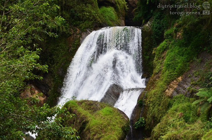
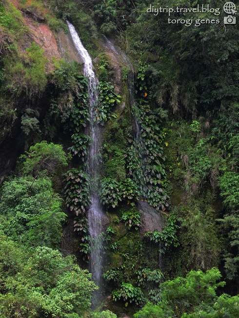
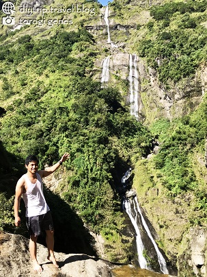
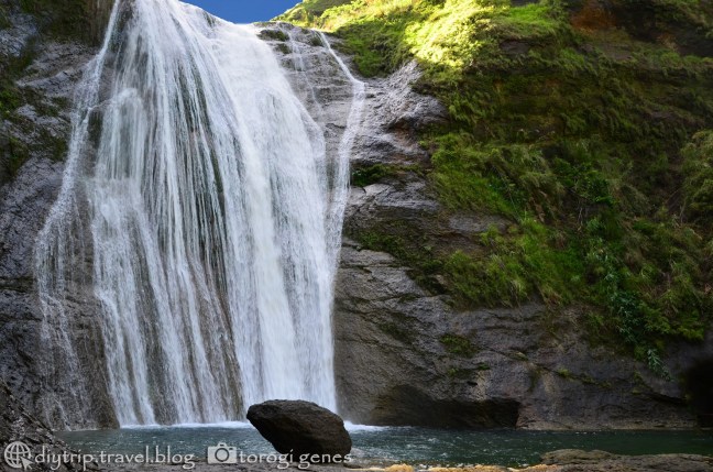
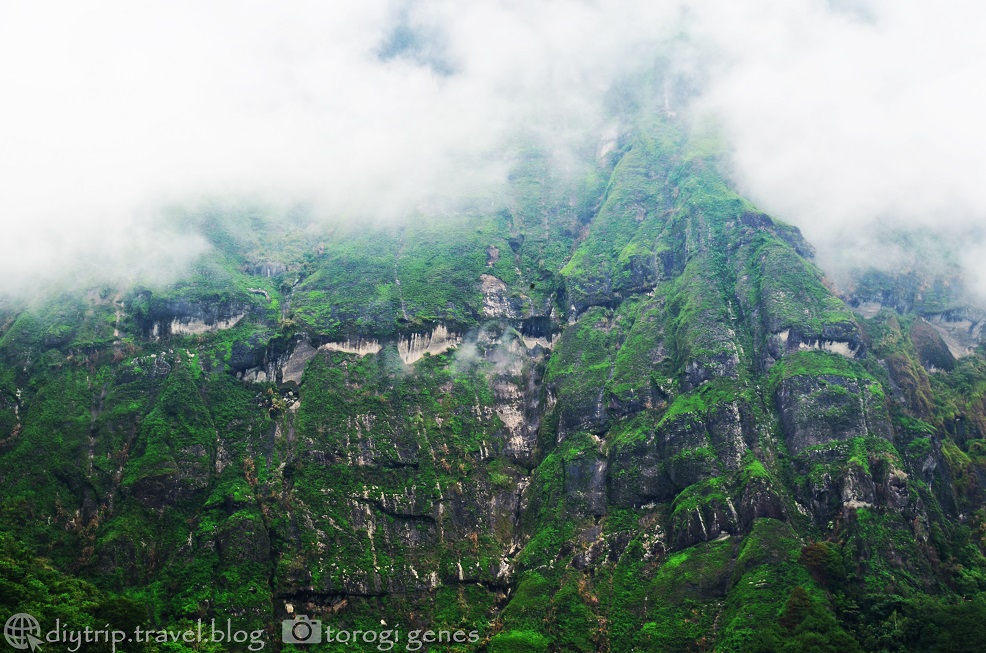
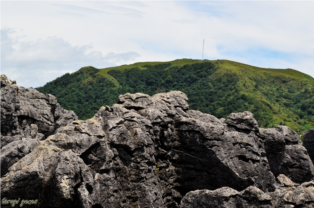
A newly formalized hiking destination, Mt. Ulap Eco-Trail, a less-than-an-hour drive from Baguio City, offers six stations which boast majestic views of Cordillera mountains, pine forests, grassland ranges, man-made stone stacks, picturesque boulders, and a faraway glimpse of the San Roque Dam and Philex mining area.
Mt. Ulap Eco-Trail is in close proximity to Baguio City unlike other popular hiking destinations in the region such as Mt. Ugo and Mt. Pulag. Travel time would be about 45 minutes depending on the traffic at the central business district. En route, you will pass by Camp John Hay, Philippine Military Academy, and Texas Instruments. Don’t get confused with the arch indicating Ampucao Elementary School at the drop-off area. Both the elementary school and barangay hall are located in the same compound. There is a table for registration with logbooks for Baguio City and NCR hikers attended by an officer. You will pay here the registration fee and guide fee. You will be assigned a guide according to the local queuing. An environmental orientation by your guide is a must before leaving the barangay hall. There are foods and bottled drinks peddled in the area, so don’t get nervous when you forgot to buy bottled water for the hike. There’s clean comfort rooms in case you need to attend to nature’s call or change clothes before the hike.
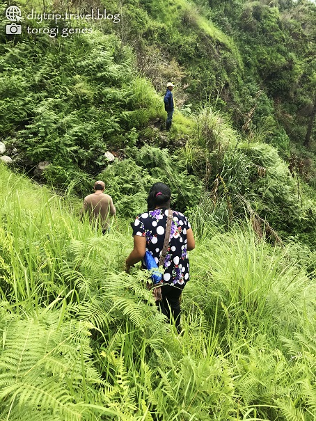
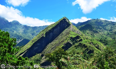
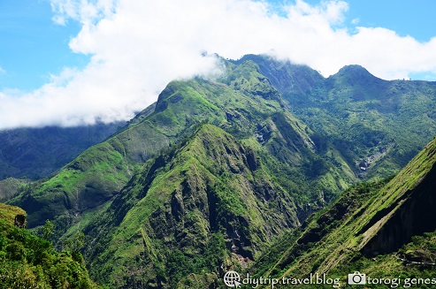
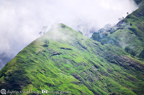
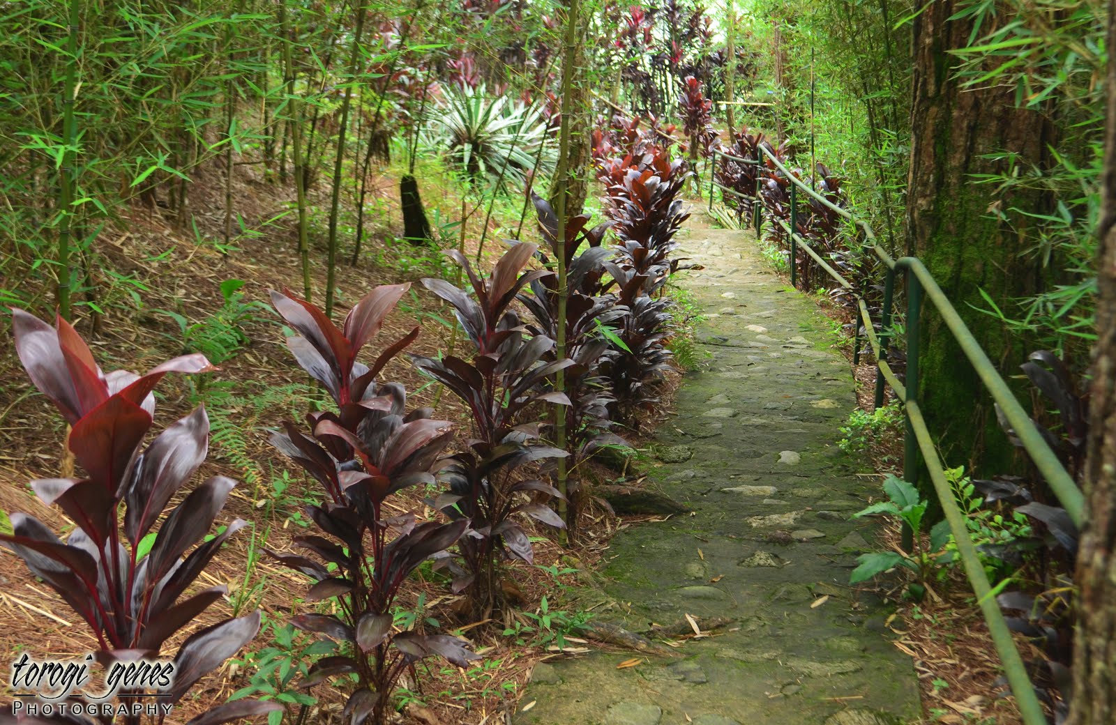
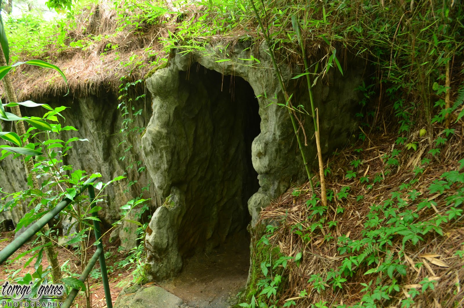
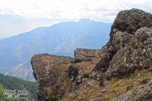
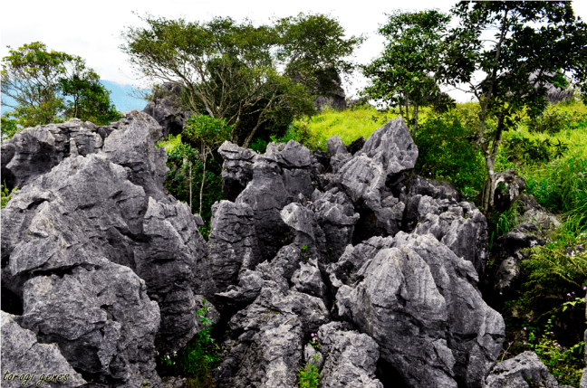
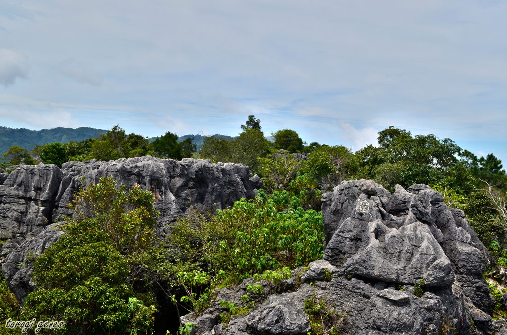
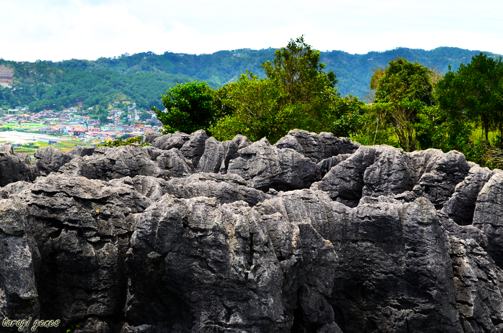
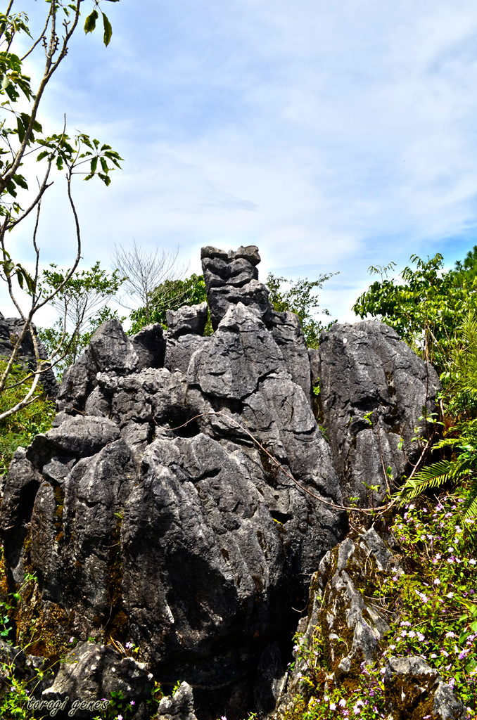
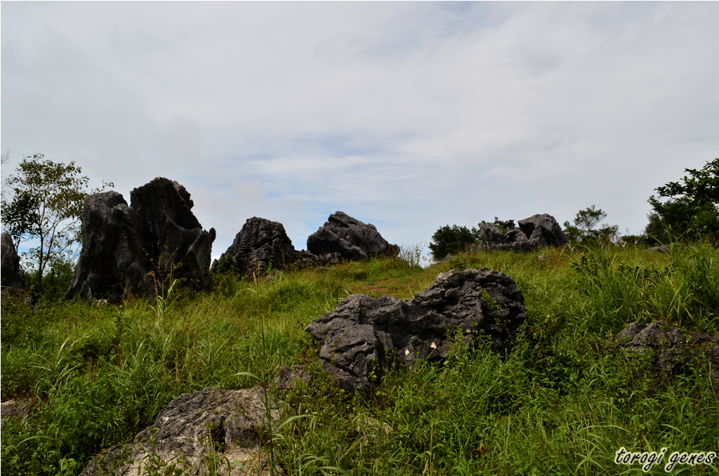
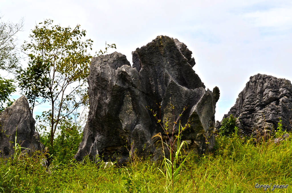
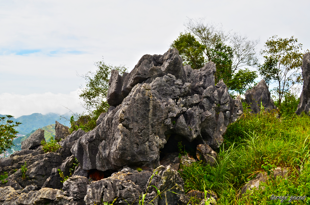
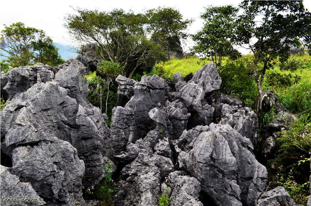
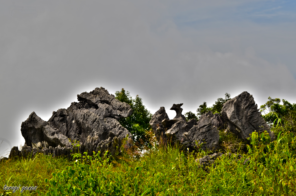
There are six stations along the trail. Tomtombek, the first station, is an easy walk from Ampucao Barangal Hall. A raised metal welcome board showing the stations marks the beginning of the upward assault. The next station, Ambanao Paoay, a 1,788 mASL peak, is adorned with man-made stone stacks. You may add your own design in here. Careful however not to erect it along a footpath. Camping is allowed at the lower portion of this station. Also, along this station, a portion of the San Roque Dam and Philex mining area can be seen. The third station, Gungal, at 1,814 mASL is characterized with rock boulders. Some tourists say that this part is the highlight of the trek. Taking a solo shot at the famous, pentacle-vandalized, Gungal rock seems to appeal to most hikers, thus making this the most populated station during the day. The fourth station and the 1,846 mASL summit, Mt. Ulap, is covered with grass. A concrete marker is seen in its highest point inscribed with the name of the Engineer who surveyed the area. Most of the campers favour this area than in Gungal. For campers, the magical sunset and sunrise is often sought here. There is a store and two open pit comfort room near the camping area. The fifth station, Pong-ol burial cave, is now closed to the public. Desecration of the sacred place as well as dangerous path are the reasons for its closure. Midway along the downhill path to the fifth station is a barricaded burial rock left. However, only a few bones were left by mummy thieves. Sta. Fe, the sixth station, marks the end of the trek.
Officially launched on 31 October 2015, hiking through Mt. Ulap Eco-Trail now means paying standard fees and adhering to its rules and regulations. According to a local guide, tour guide fees costs about Php500.00 before its official opening. Environmental prep talks is not done thus vandalism as well as desecration of the sacred burials areas is uncommon. As of April 2016, the Pong-ol Burial Caves is now closed to the public.
Reminders
·         Practice the Leave-No-Trace (LNT) principle when visiting and camping.
·         Do not vandalize the stone and tree trunks.
·         Closing of registration at Ampucao Barangay Hall is 2:00PM. If you are a slow hiker, register before lunch or earlier if you don’t intend to camp for the night.
·         The fees including the guide fee are standardized. There’s no bargaining for lower price. Take note that the fees are lower compared to other eco-trails.
·         During holidays and weekends, registration starts as early as 4AM. However, to make sure of the availability of an officer at the barangay hall, It doesn’t hurt to inform the Tourism Council through the numbers listed above.
·         To those who are not regular hikers, take time to prepare yourself physically and mentally.
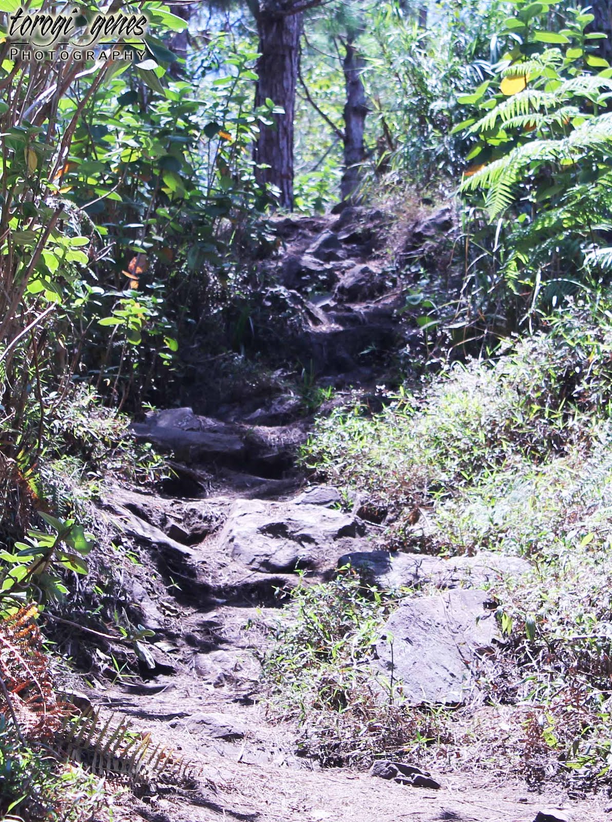
·         The foot paths are slippery during rainy season. However, you still need to be vigilant during summer because the dried soil easily crumbles under when stepped on.
Gallery
The metal signage that marks the start of the six stations.
These are the sic stations of the Eco-Trail. However, to protect and preserve the sacred burial site, the Pong-ol Burial Cave is now out of the regular trail offering.
The trail is slippery during rainy season but the danger is as much present during summer. You need shoes that can conquer the dry, brittle and pebbled footpaths. Sprained ankle is one of the most common injuries to hikers during summer.

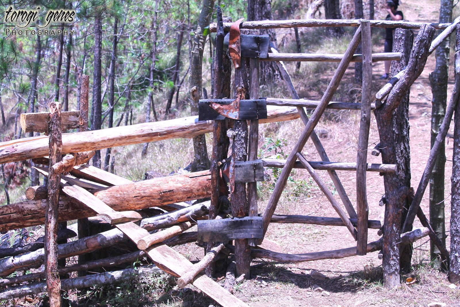
These are gates for cattle. Never open and pass through these gates; use the wooden makeshift stairs.
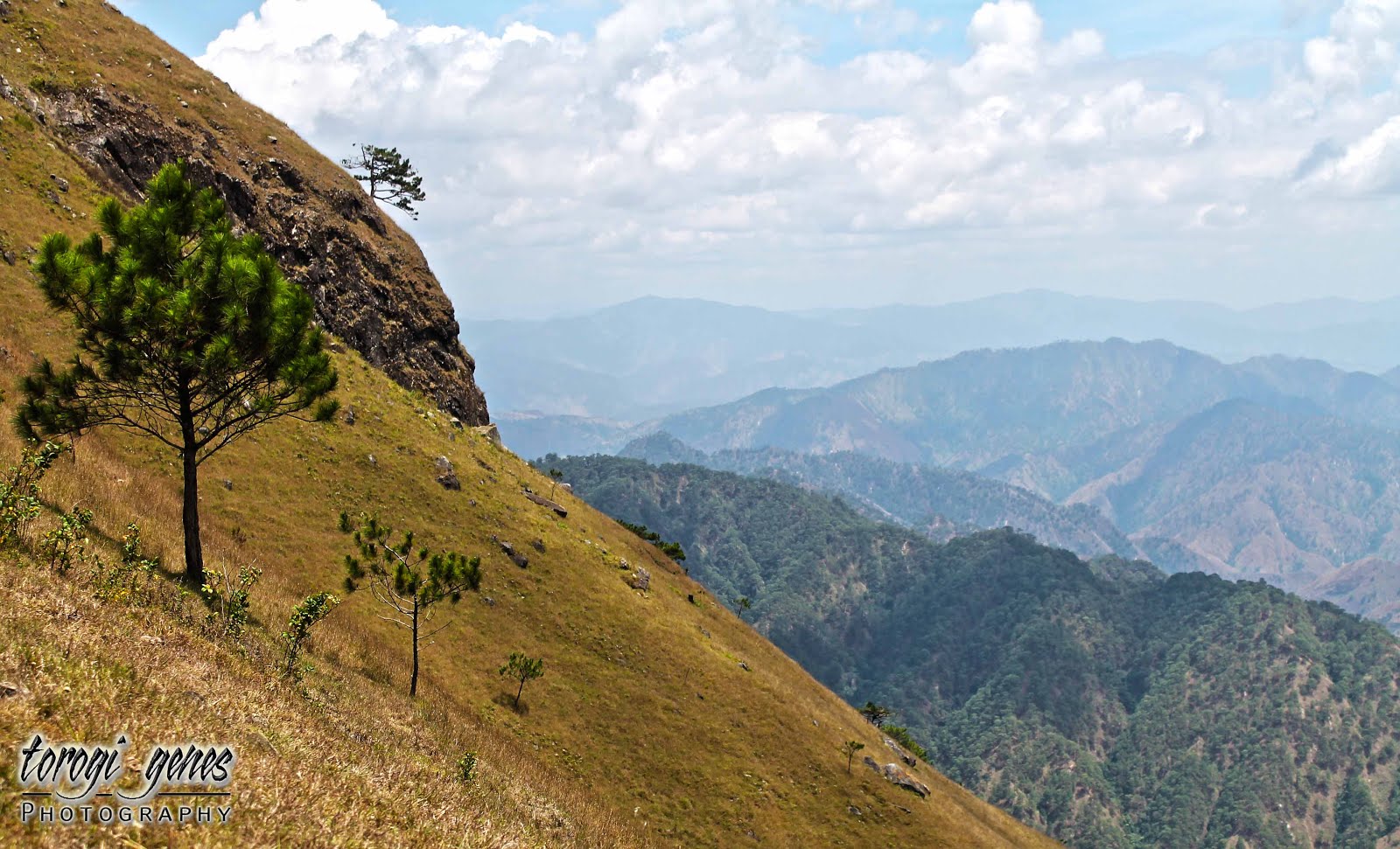
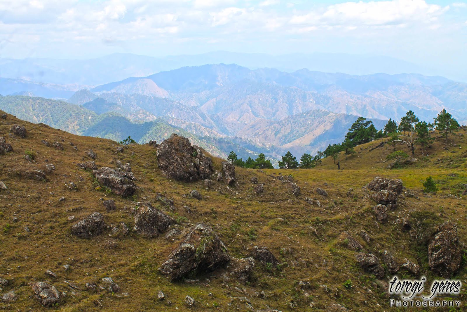
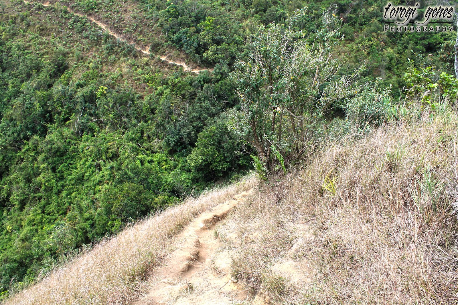
This is the first boulder along the trail where you can have a glimpse of the picturesque Itogon, Mt. Ugo, and even the mountains of Pangasinan.
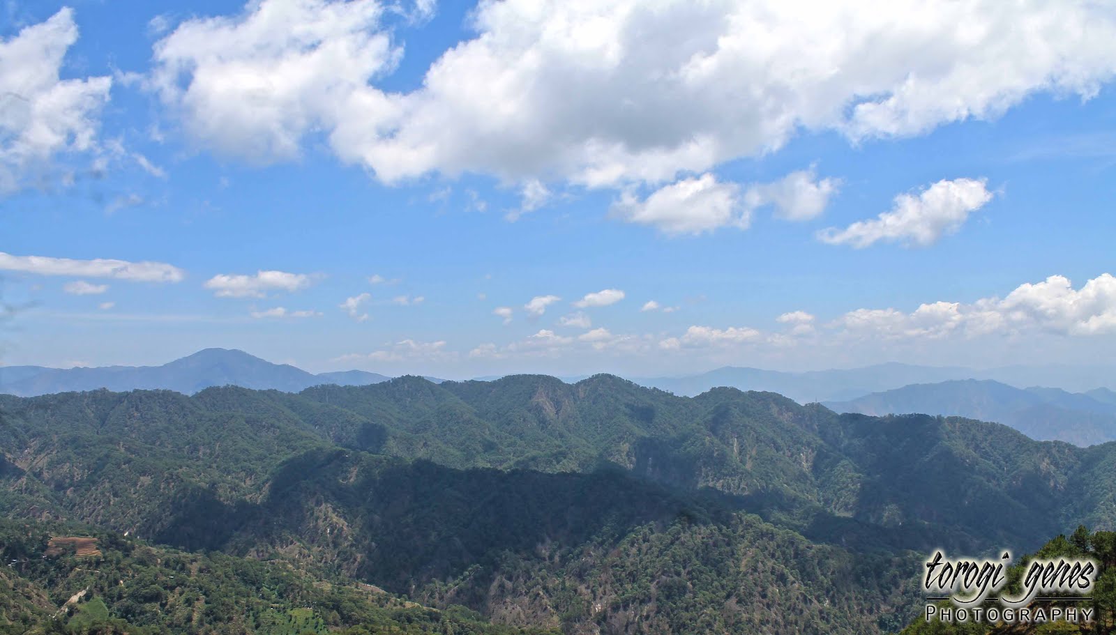
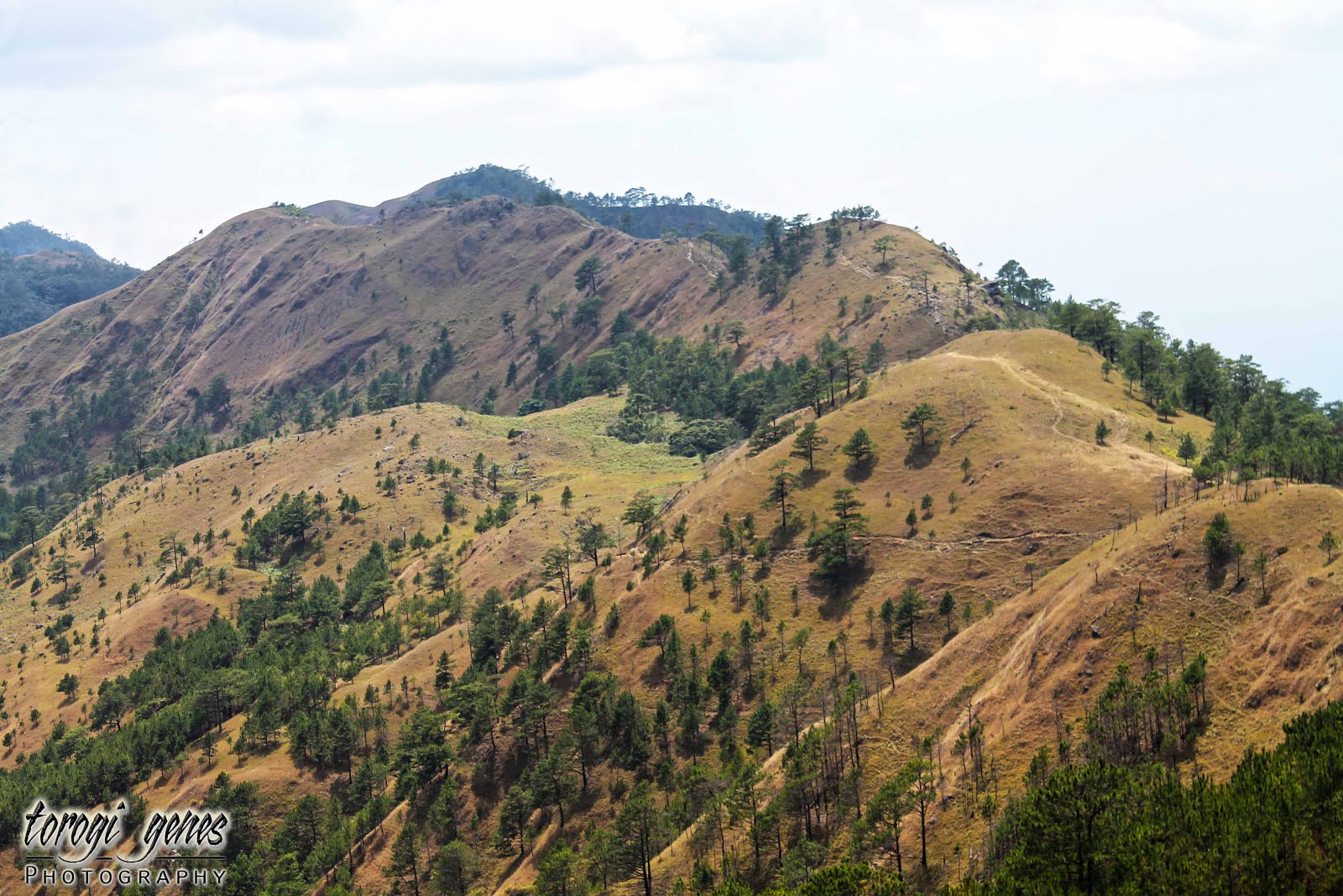
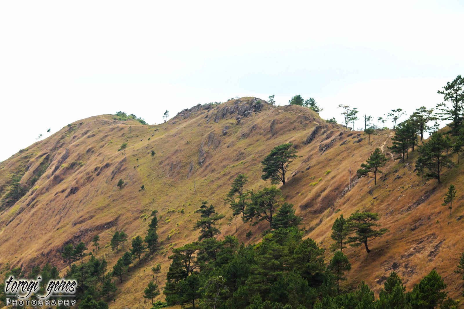
A typical yet enthralling view of The Cordillera.

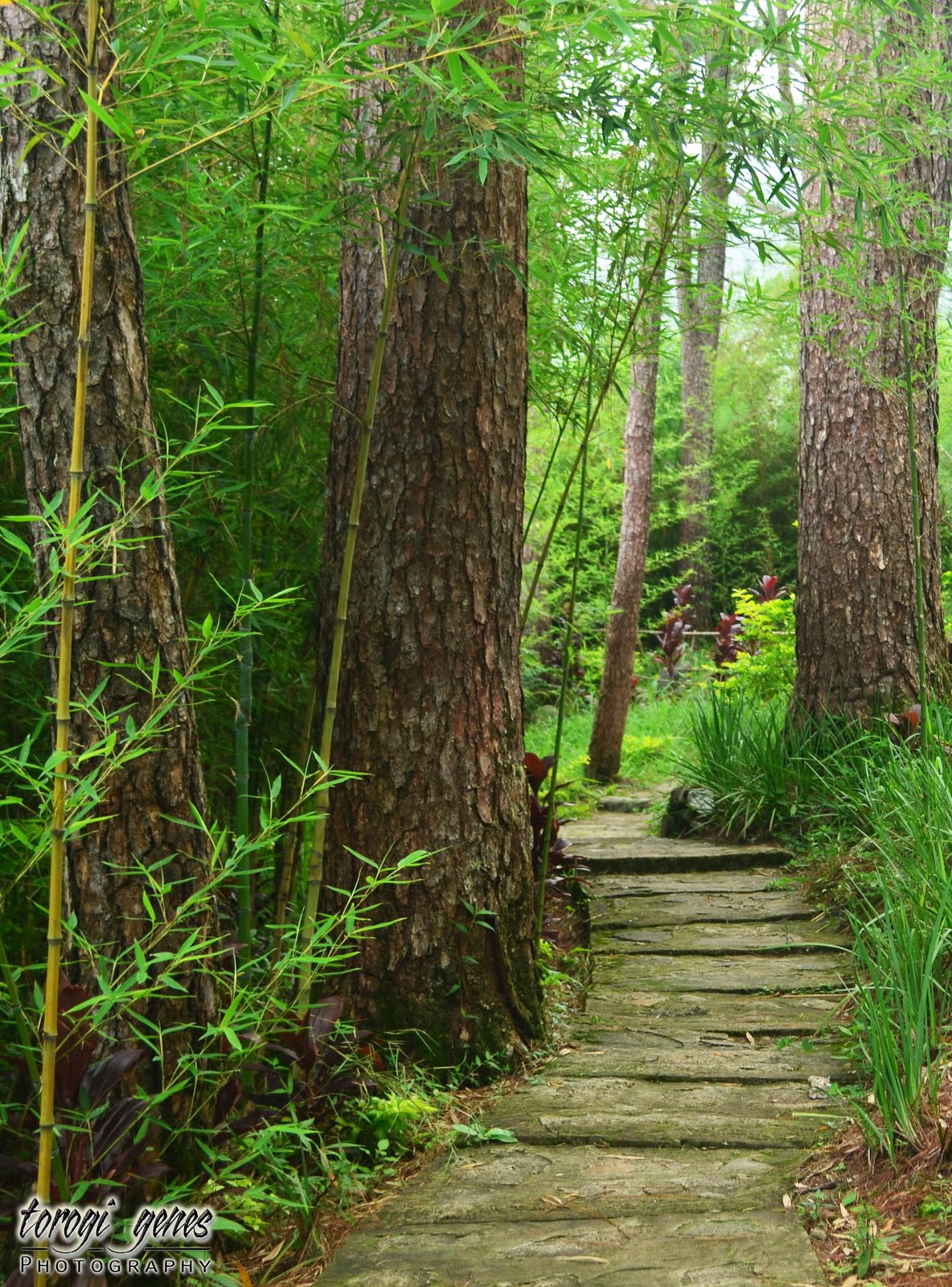
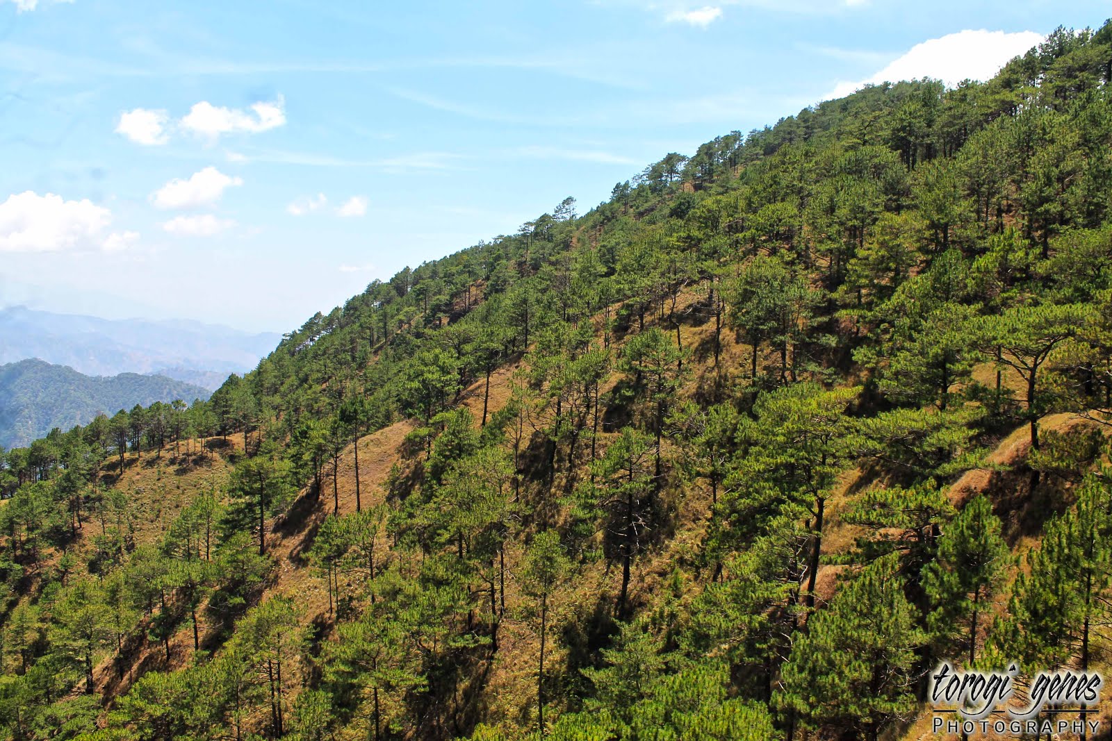
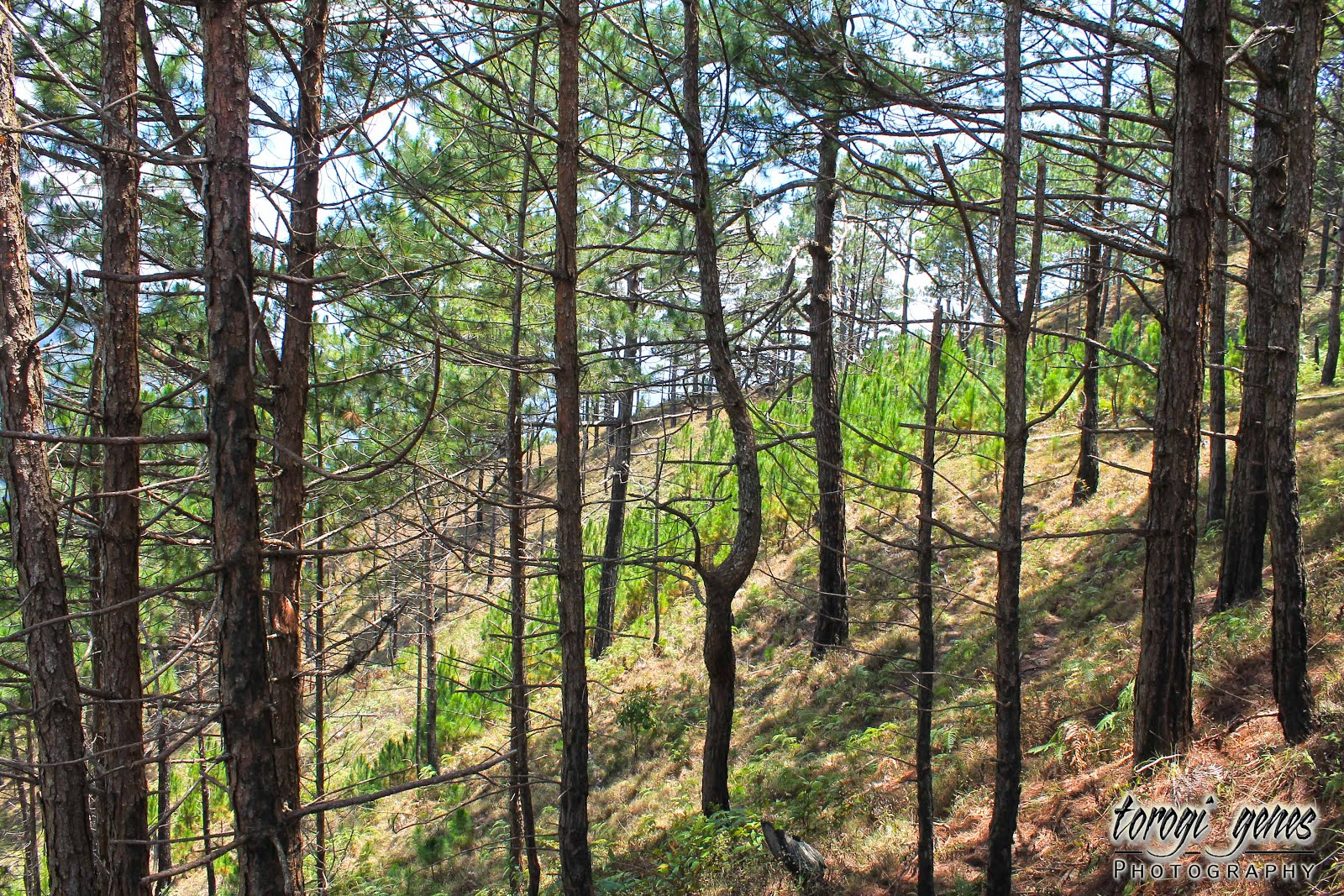
Pine trees and more pine trees but you’ll never get tired of it.
A corral for cattle branding.
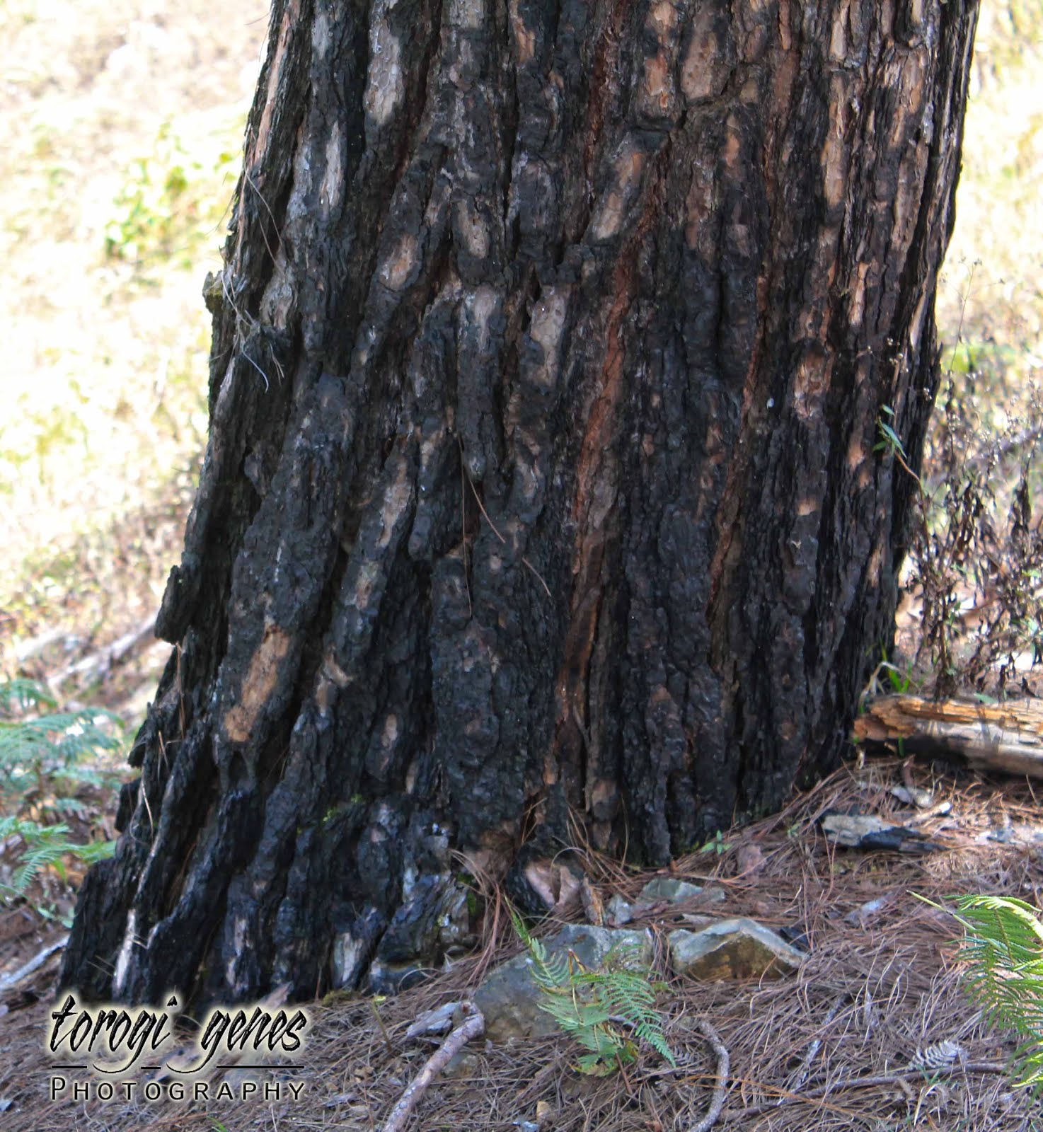
Notice that most of the trunks are scorched. During summer, the dried pine needles are very combustible. Please be responsible not to cause fire during your visit [to any mountain].

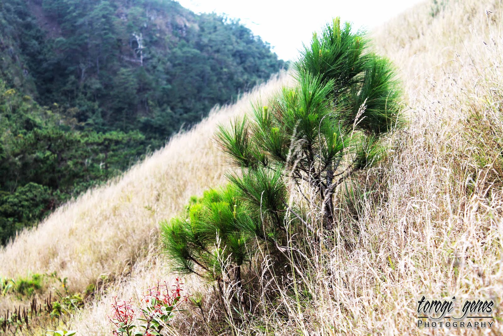
A patch of pine tree saplings.
You will notice a lot of fallen trees. This was caused by previous tropical storms.
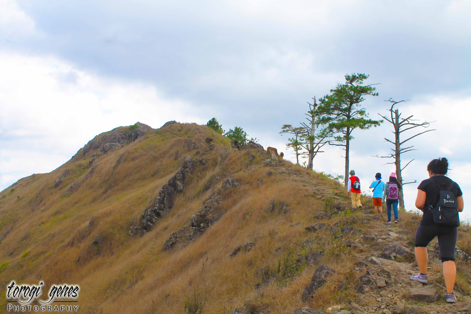
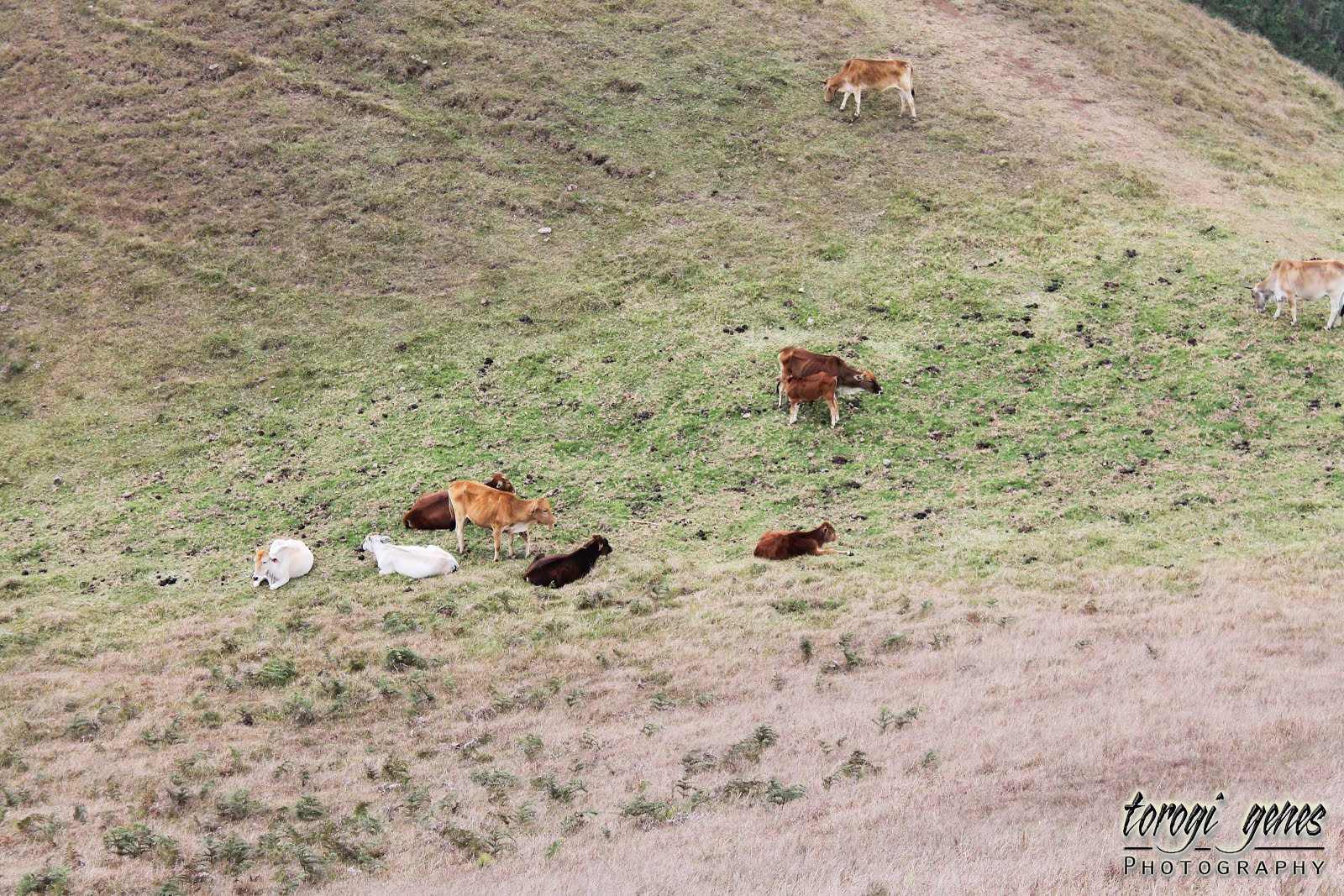
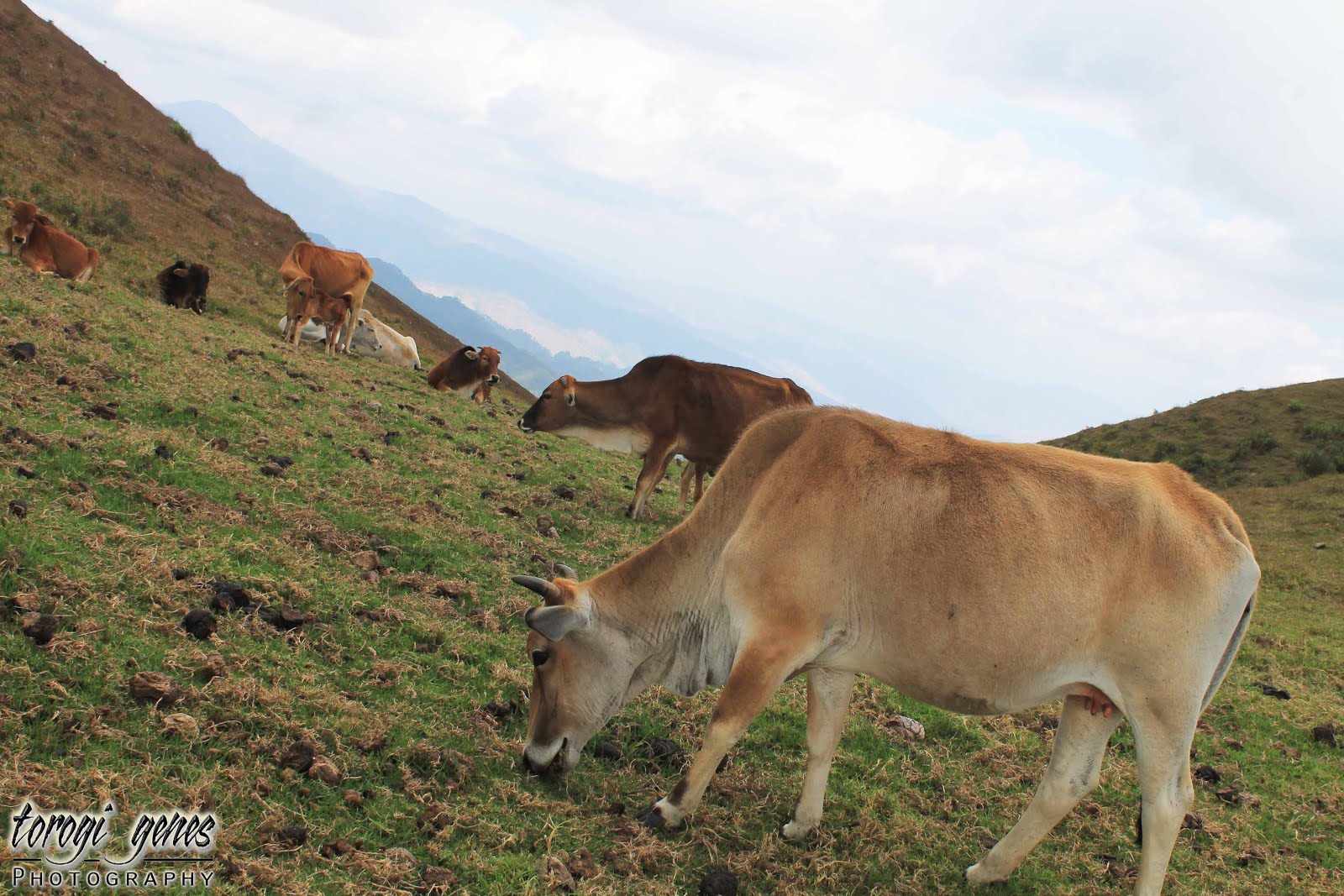
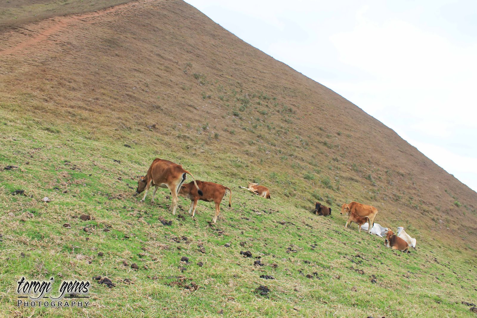
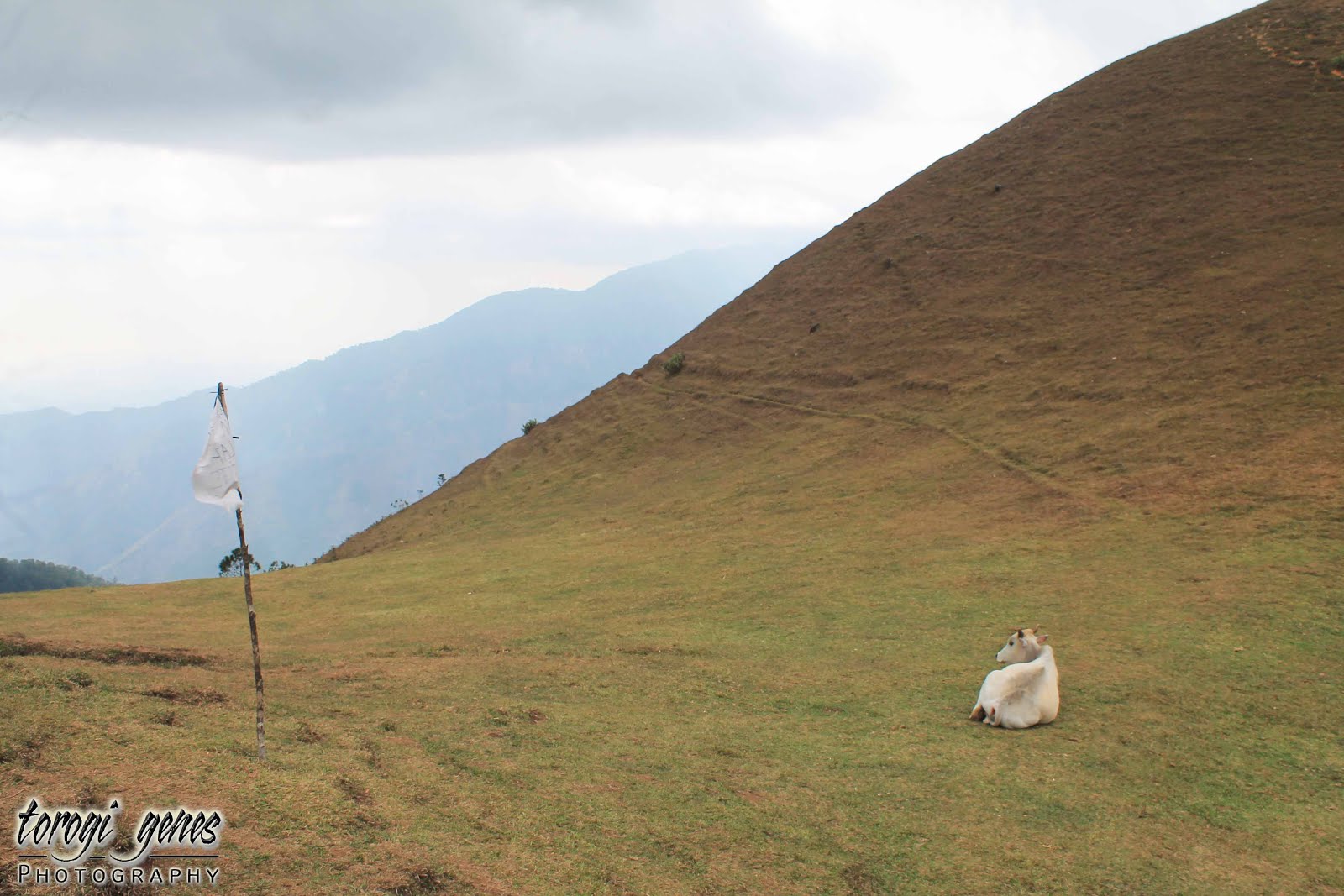
Cattle herd near the Ambanao Paoay peak.
Ambanao Paoay, the second station, is adorned with man-made stone stacks. This peak and its neighbour peak are cluttered with rocks, thus, often named as twin peaks.

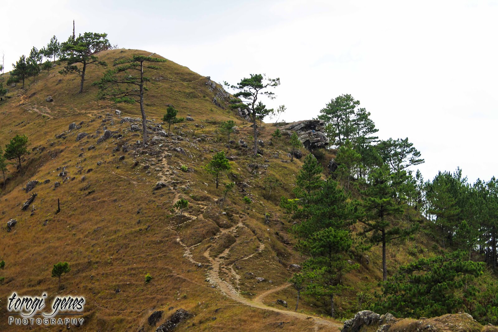
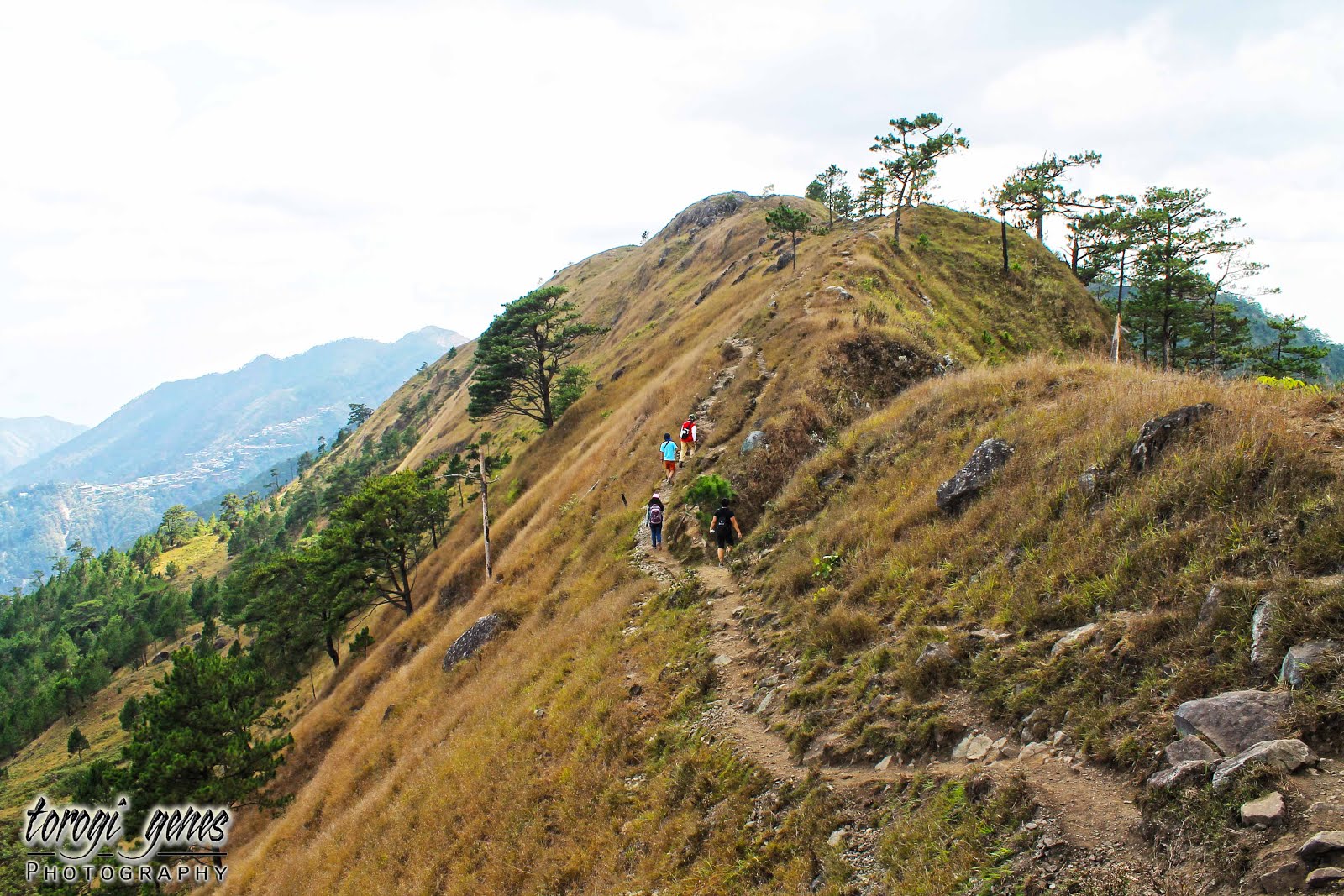
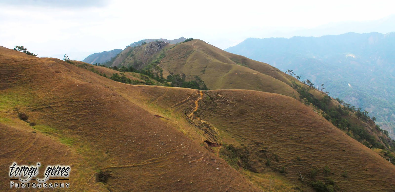
The trail ahead as it snakes along the side and on top of the mountain as seen from Ambanao Paoay.

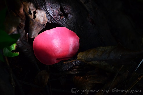
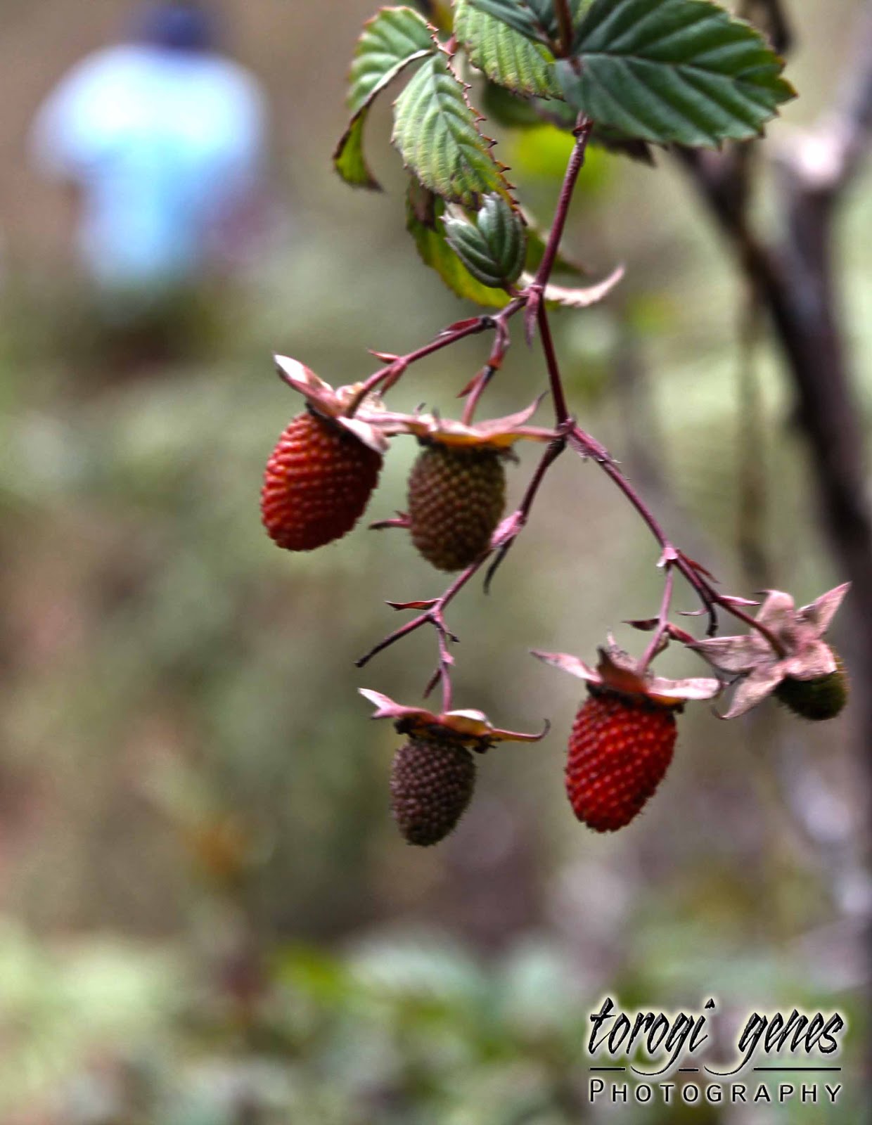
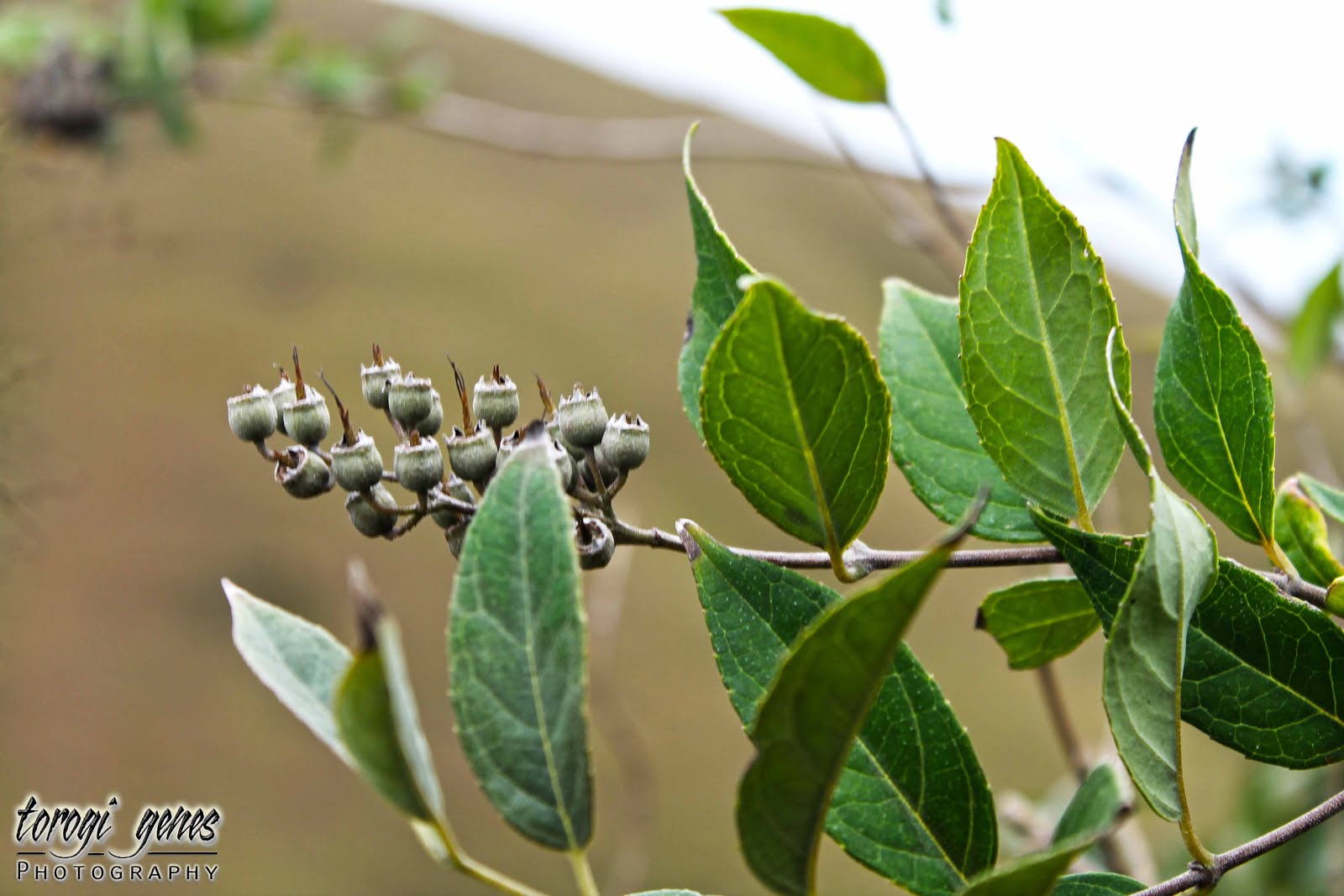
Pinit (Rubus niveus Thumb.), an indigenous wild berry in Cordillera, are commonly seen along the trail. This wild berry is edible.

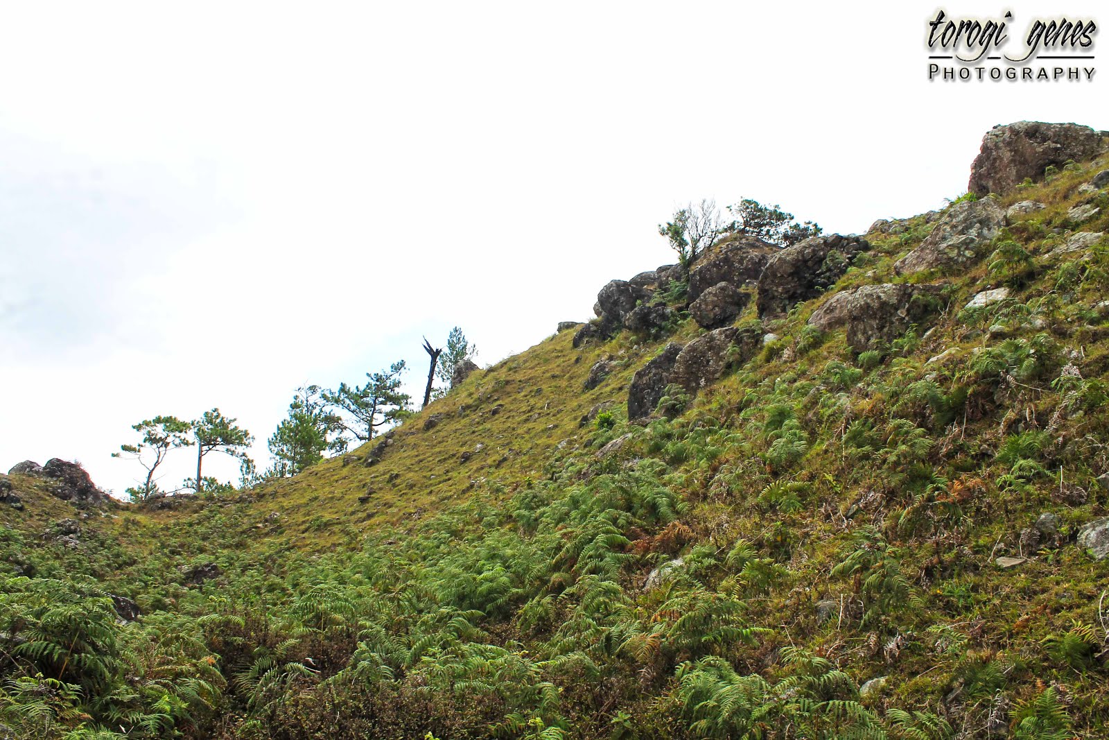
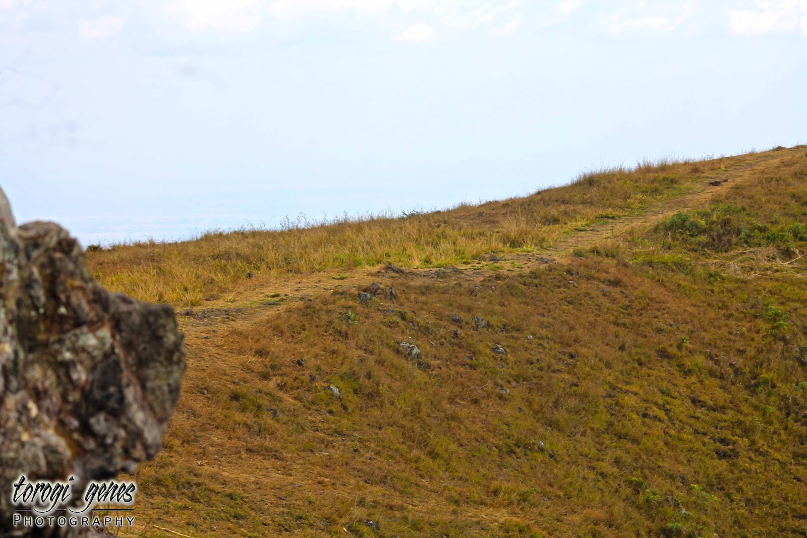
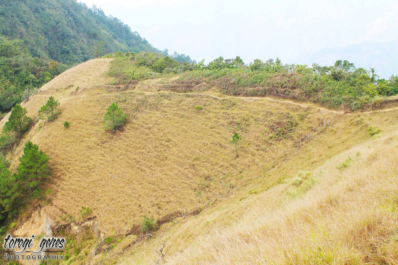
Grassy sloped and sometimes dotted with pine trees is but one of many of what the Eco-Trail can offer.

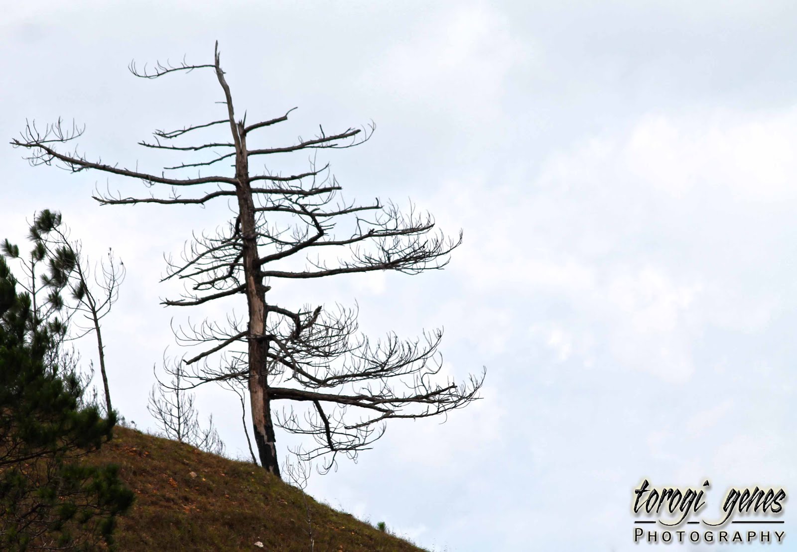
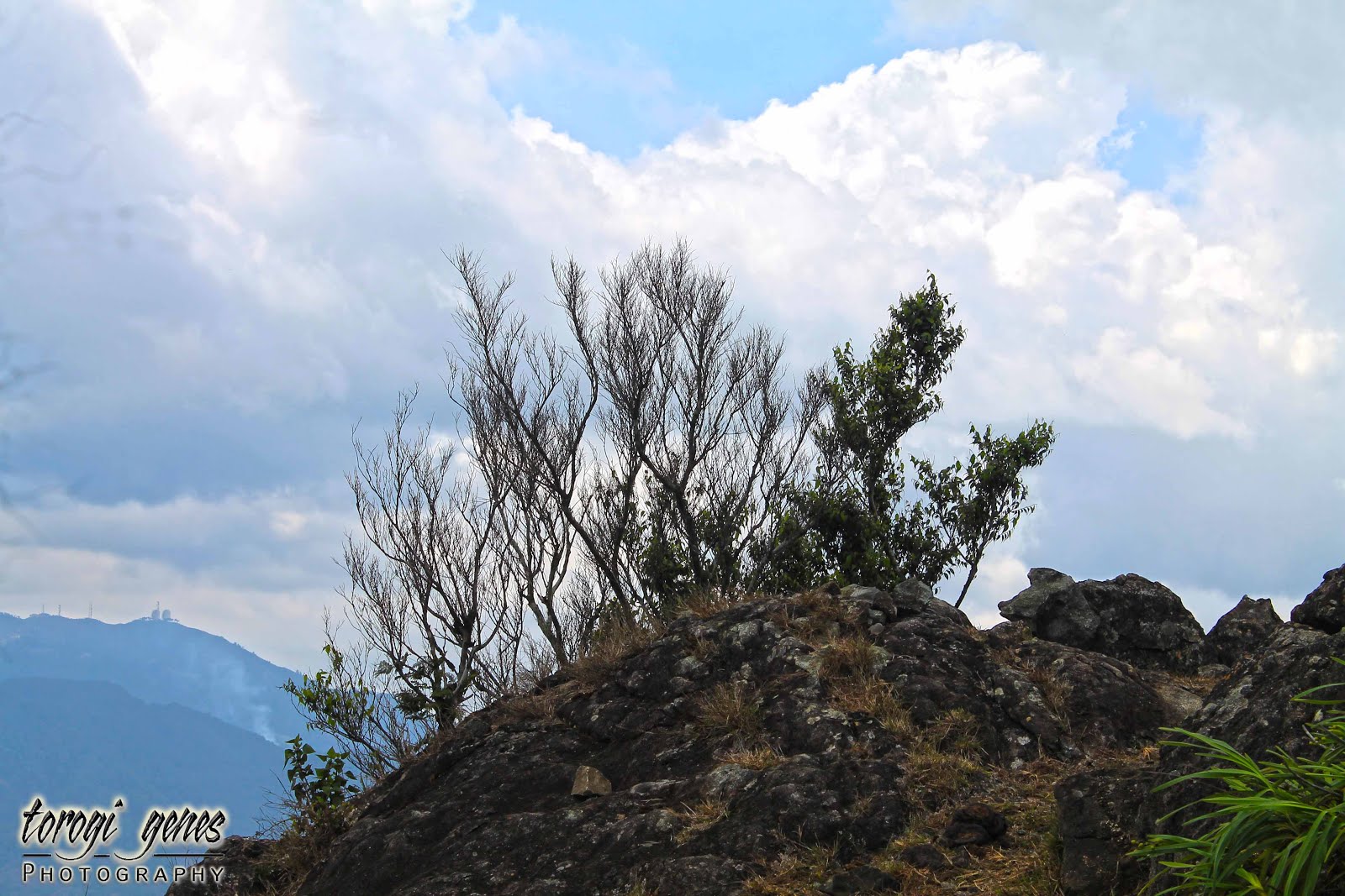
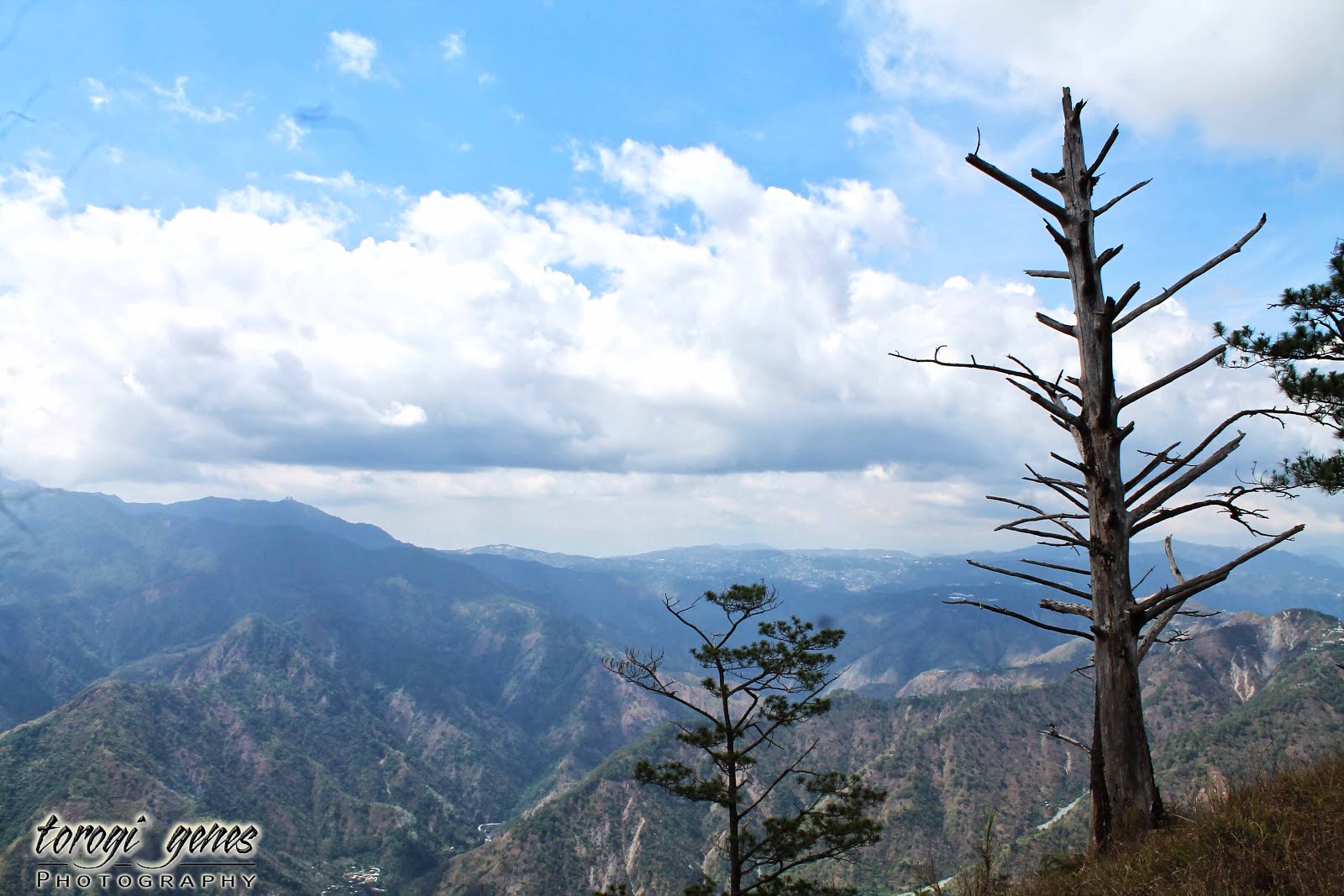
Even the dead pines trees have their own charm.

Grass-covered mountain top.

Pine trees and grassland: a perfect duo for the eyes.

You’ll love this more with a clear blue sky background.

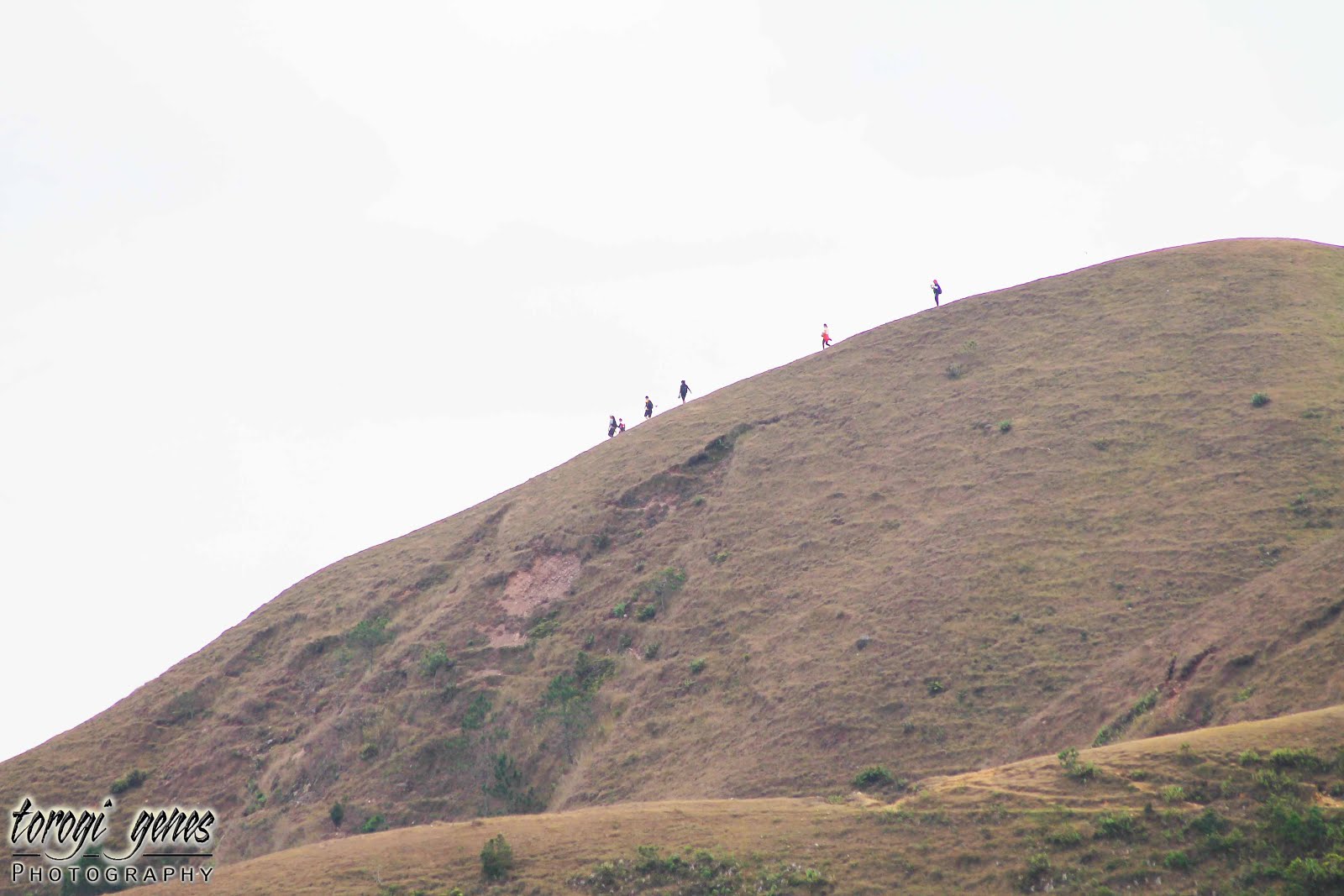
We’re not there yet.
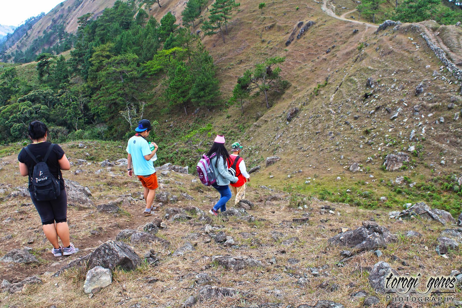
You need to be sure-footed.
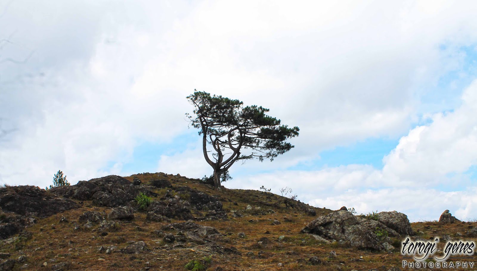
Survivor pine tree.

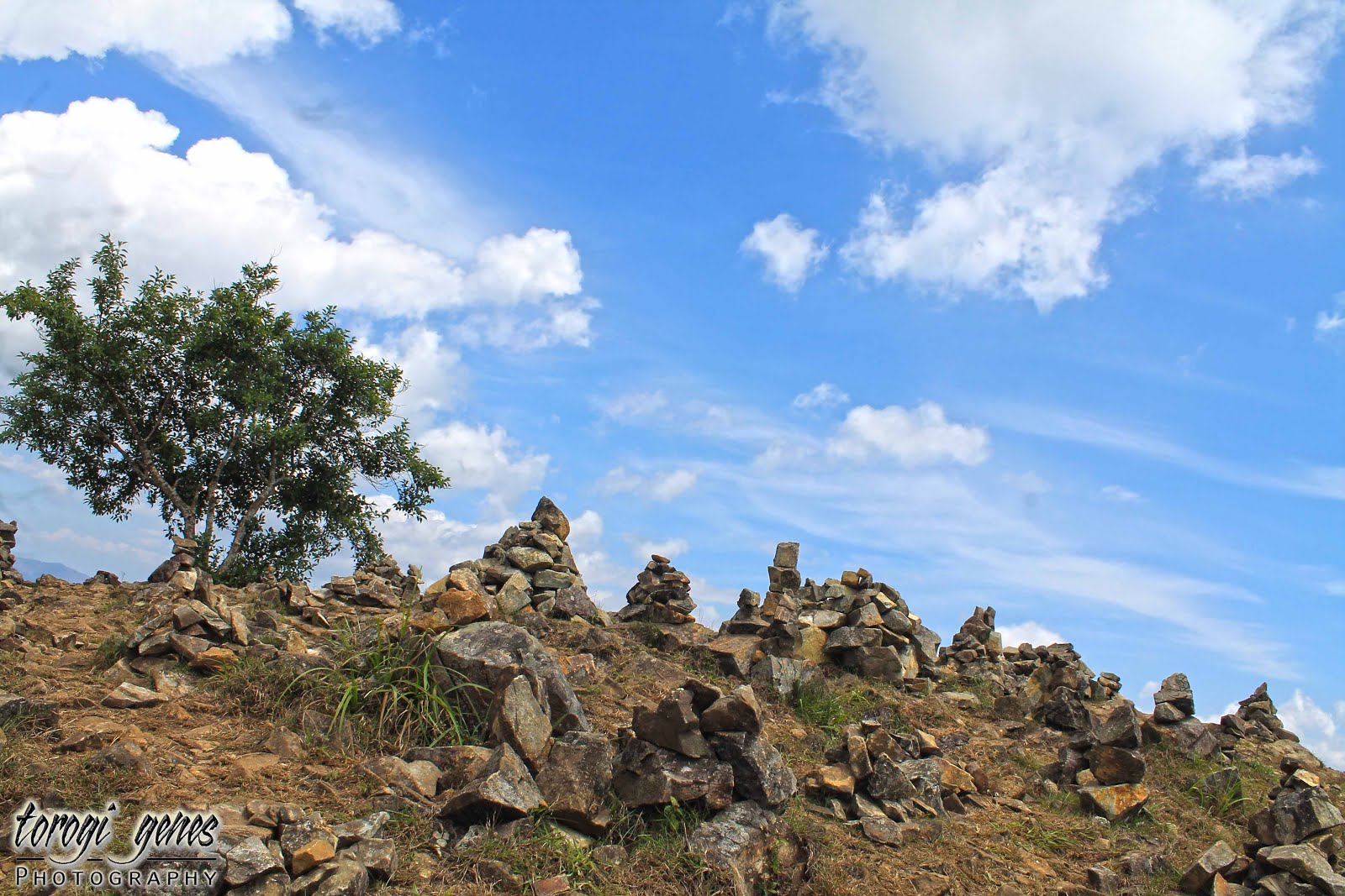
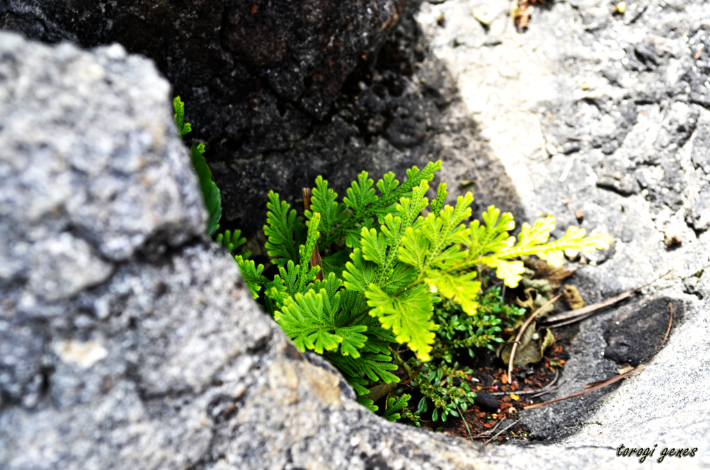
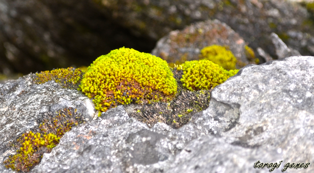
Of ferns and stones.

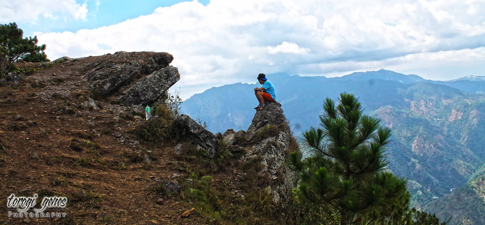
Those seconds when you just want to sit and marvel at the beauty of the mountains.
Another boulder for photo ops.
Another angle of the previous picture.
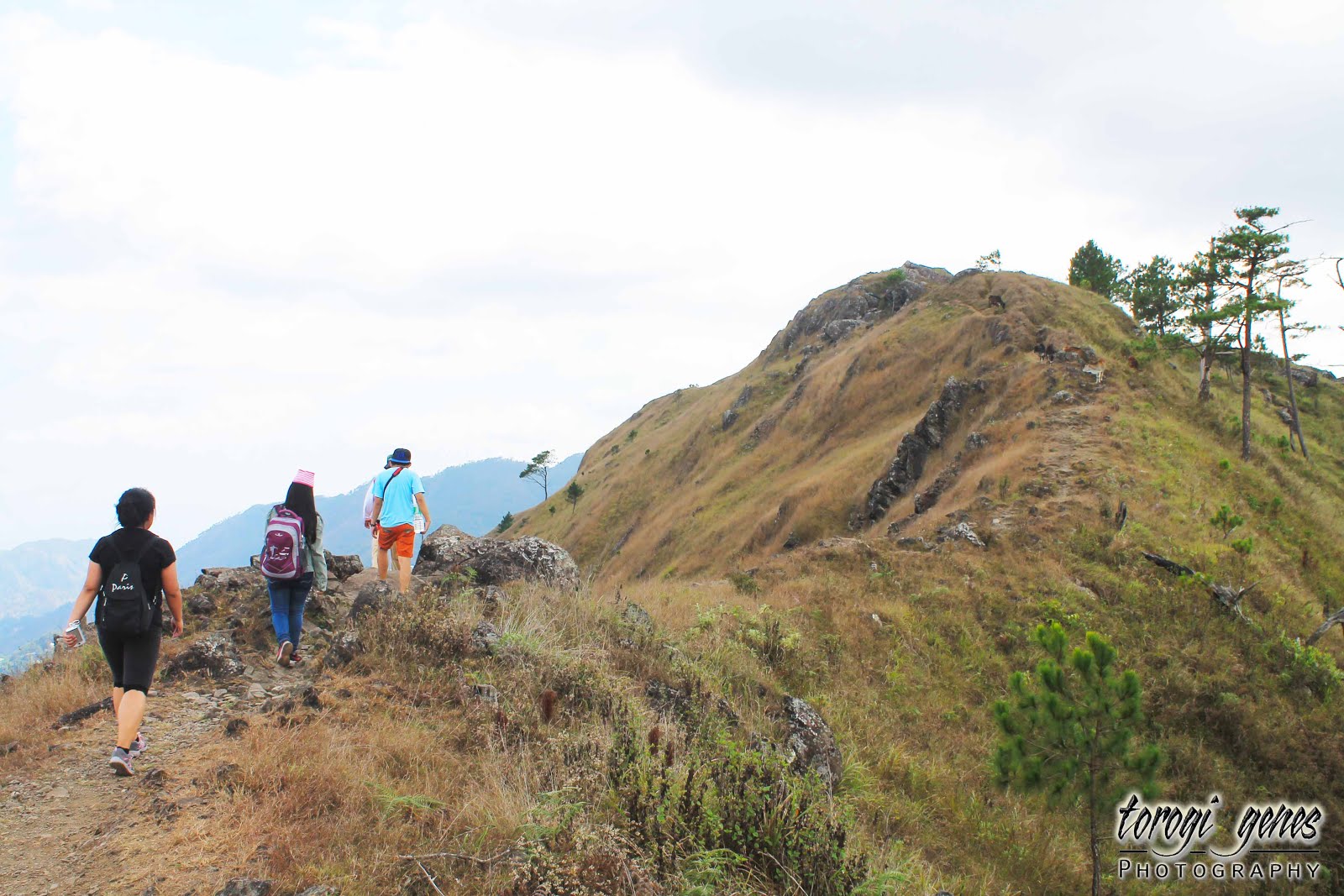
Let’s continue the trek.
Further along the trail.
Like walking at the top of the world.
Grace even during death.
And we are at Gungal station!
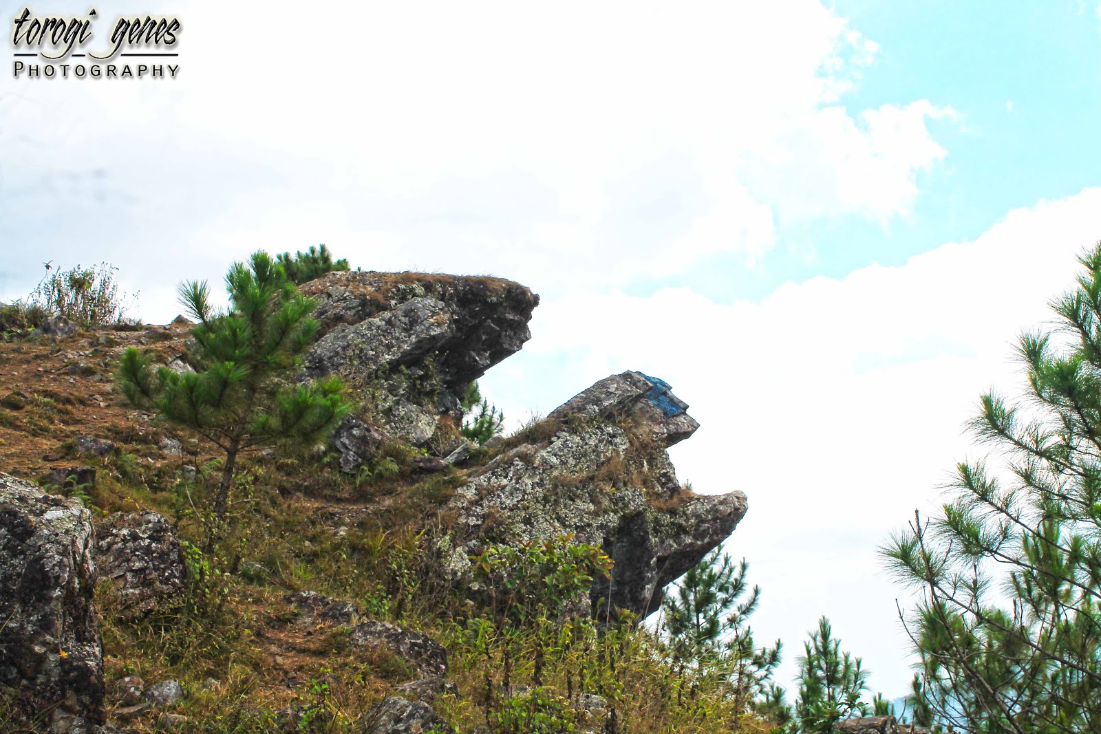
The famous pentacle-vandalized Gungal rock, where the heaviest hiker traffic happens. When taking a selfie, dangling your feet at the edge is now prohibited.
The trail out of Gungal station.
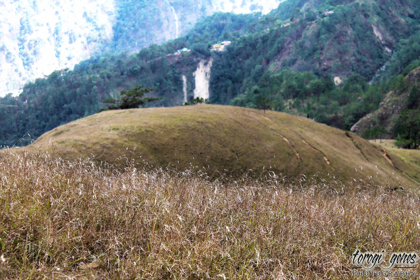
A closer look at the grass that covers the mountains.
Grassland ho!
More grassland.
The lines seen in the photo are actually cattle  paths made for years.
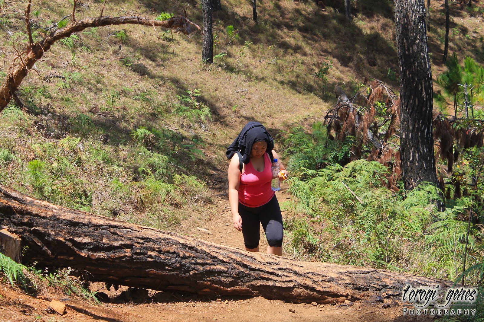
Never pull sapling when heaving your body upwards along difficult trails.
A downhill path before the upward assault to the summit.
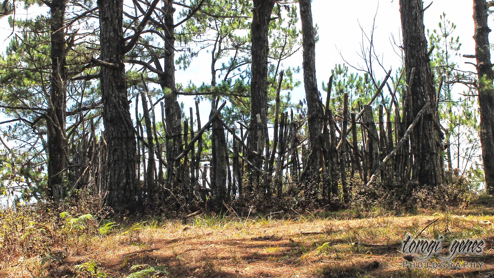
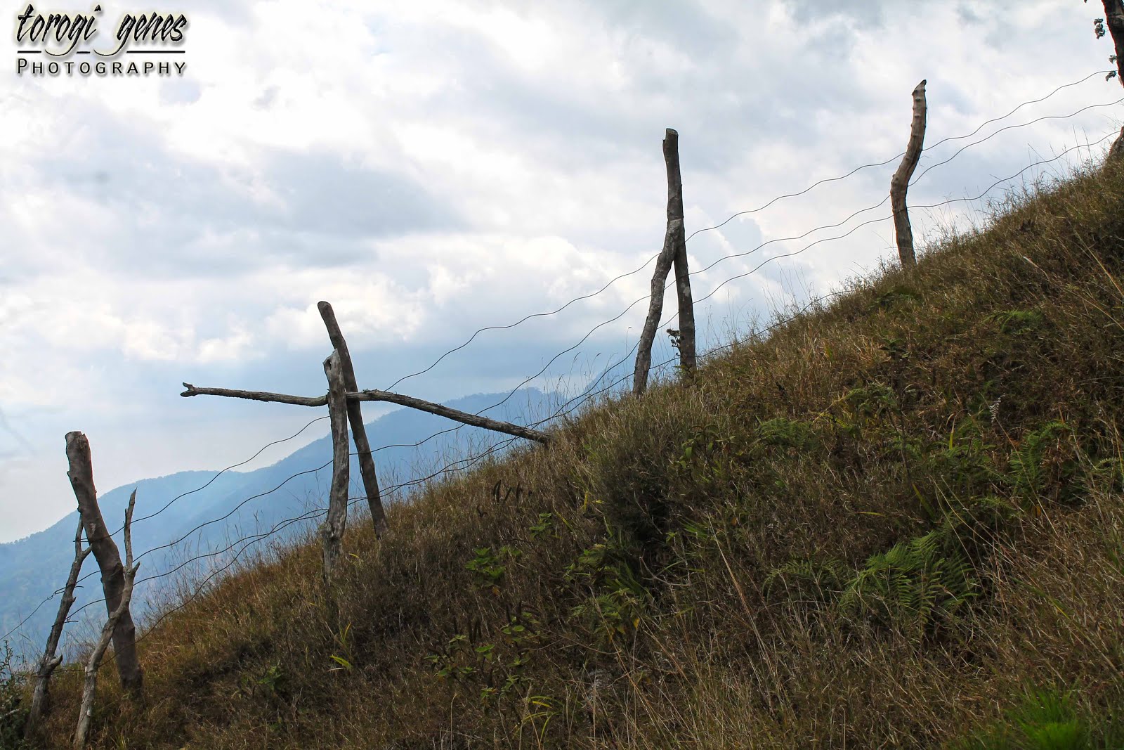
These fences either denotes the boundary of land ownership or serves as safety barricade for cattle.
  
Another indigenous plant along the trail.
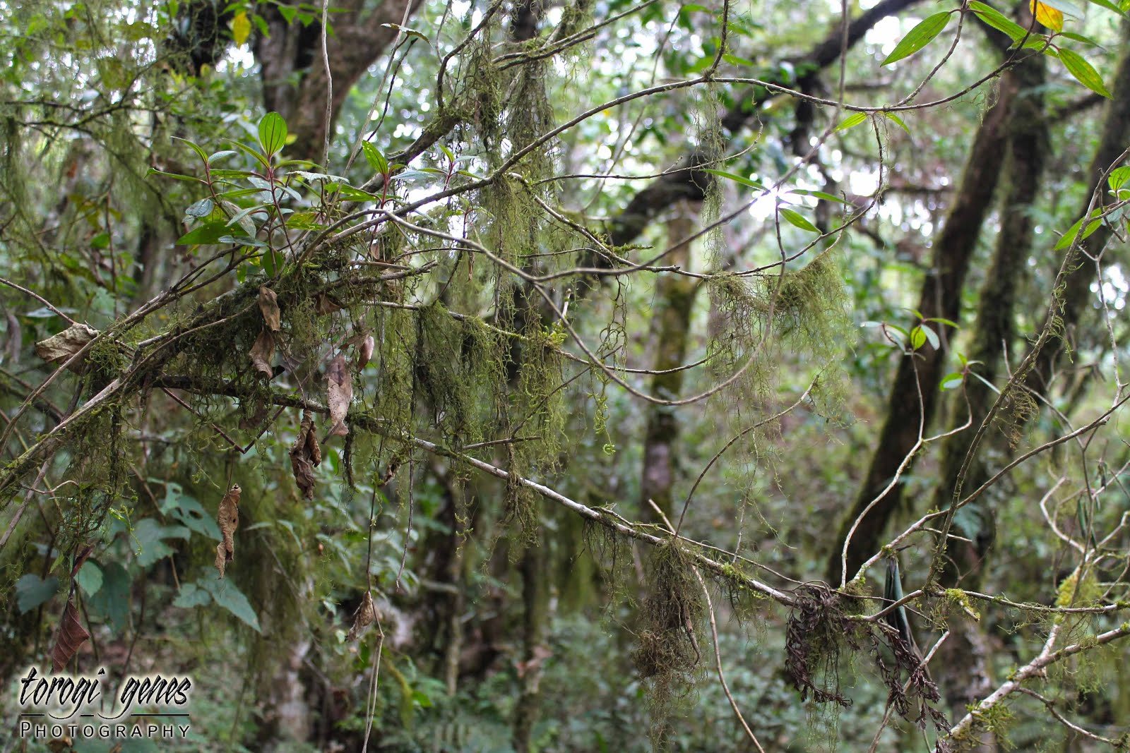
A mossy area near the summit.
The marker at the highest point at the summit. Engineer Lagman is the first surveyor of the then known as Pong-ol mountain. However, he forgot the name and just wrote what he saw, obviously, ulap (clouds).
The summit—Mt. Ulap.
Start of descend from the summit.
More cattle!
Cattle close up.
Another angle.
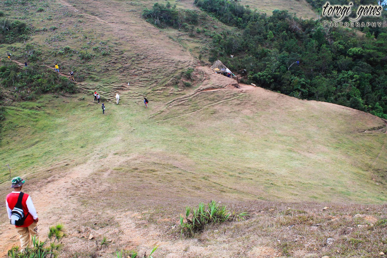
A glimpse of where we’ve walked.
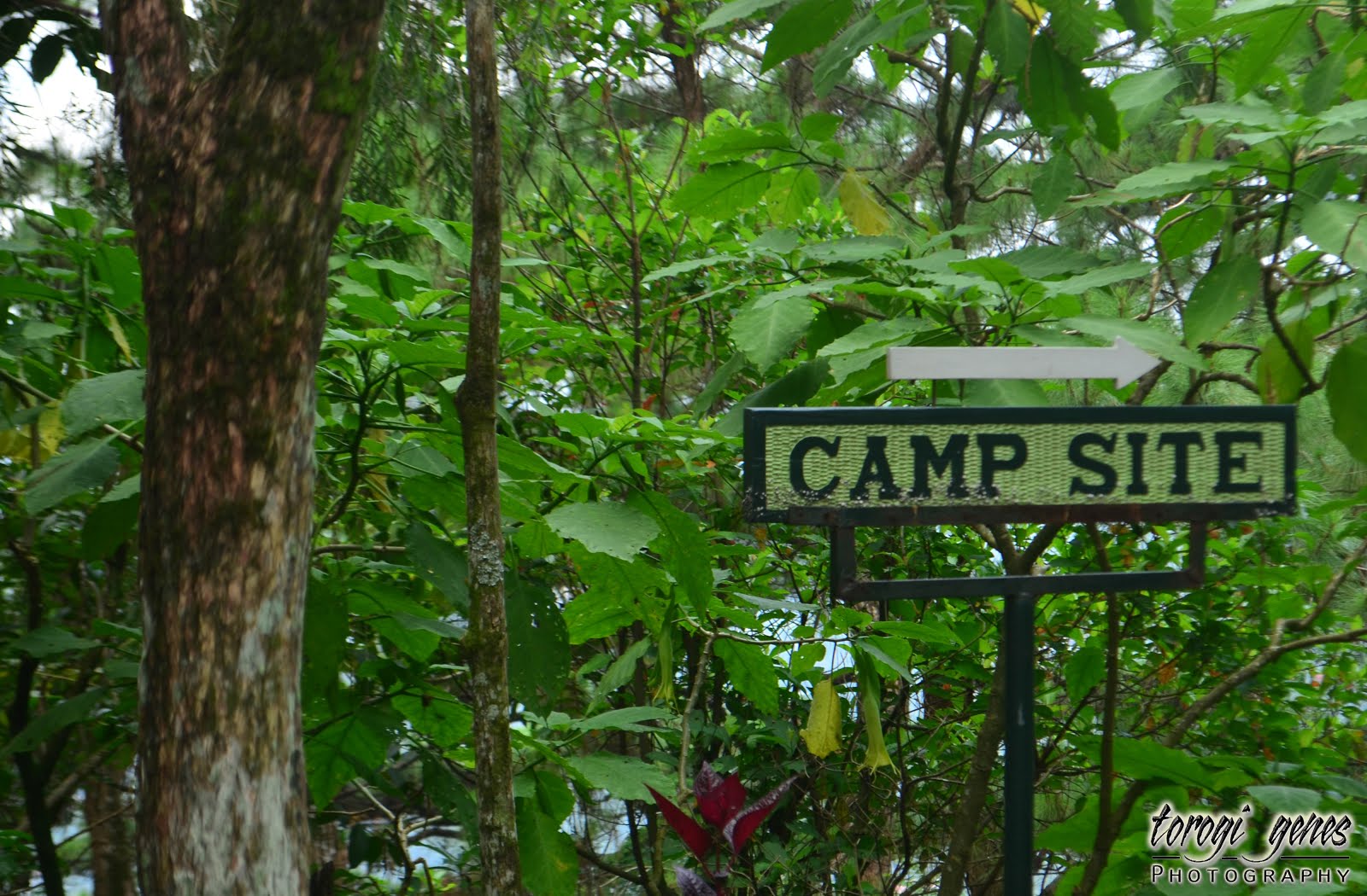
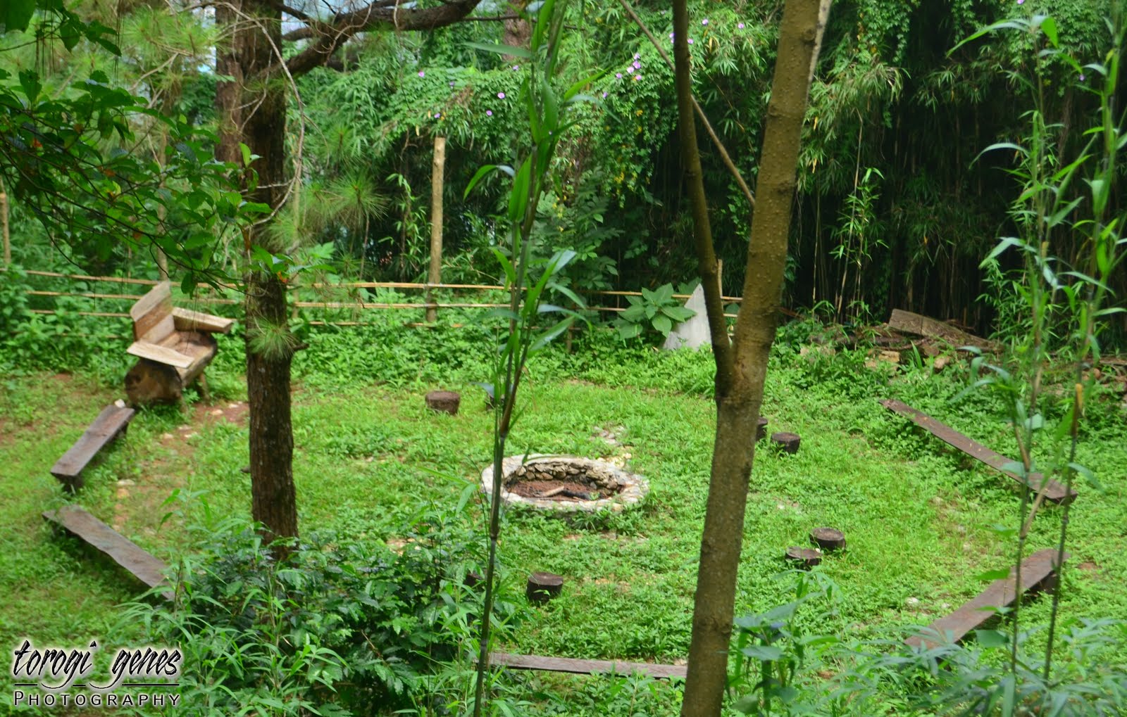
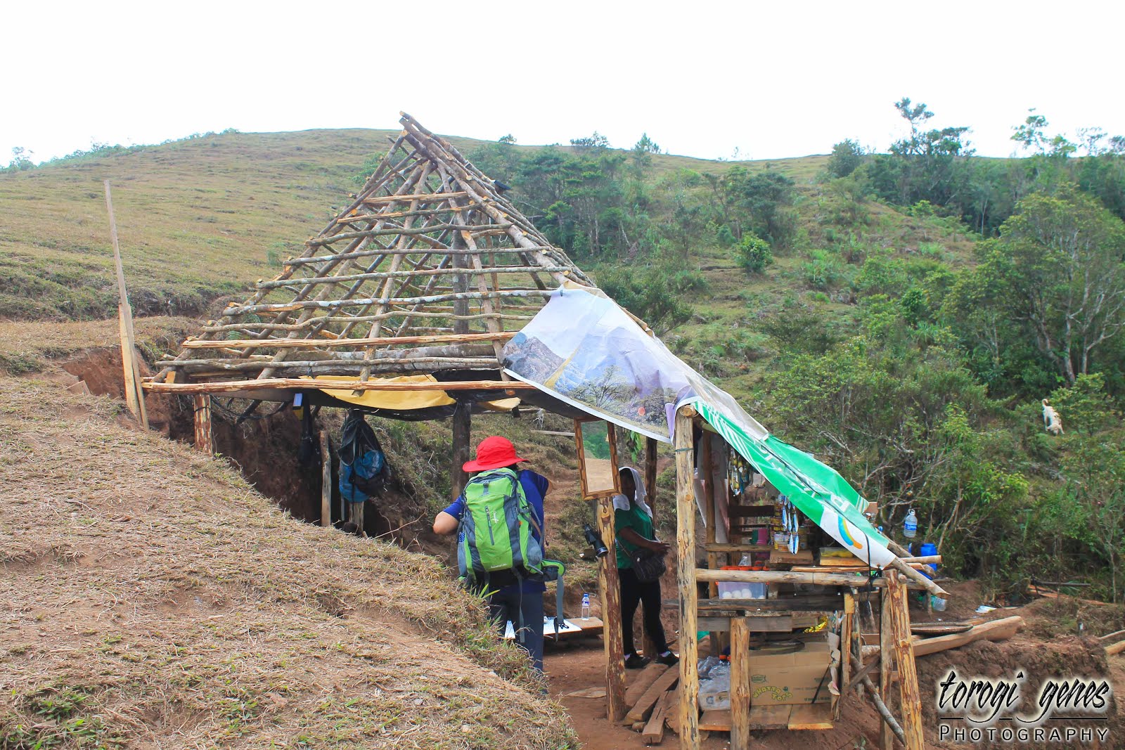
The camping site.
A stall selling refreshments near the campsite.
The camp site has a nice flat surface.
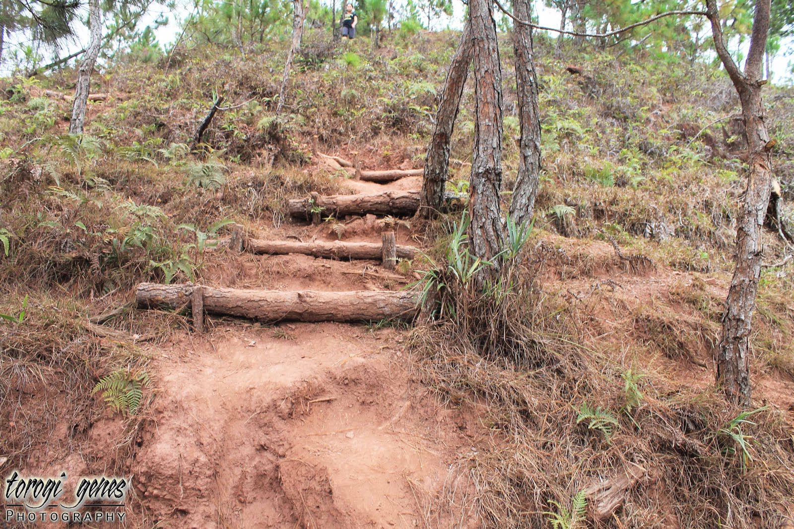
Parts of the downhill trail were steps made with pine branches.
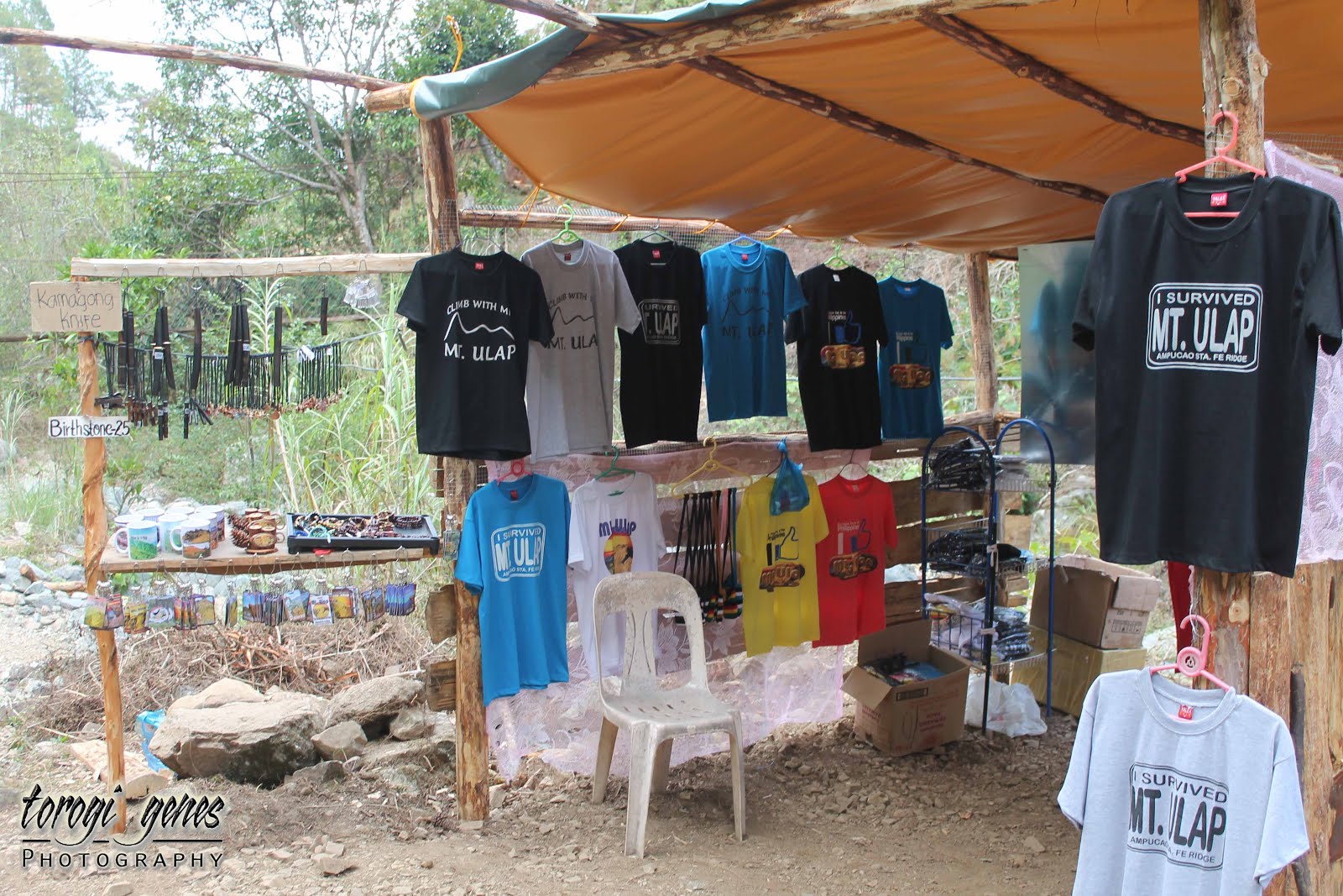
Shower areas, refreshments stalls and souvenir shops are available along Sta. Fe.
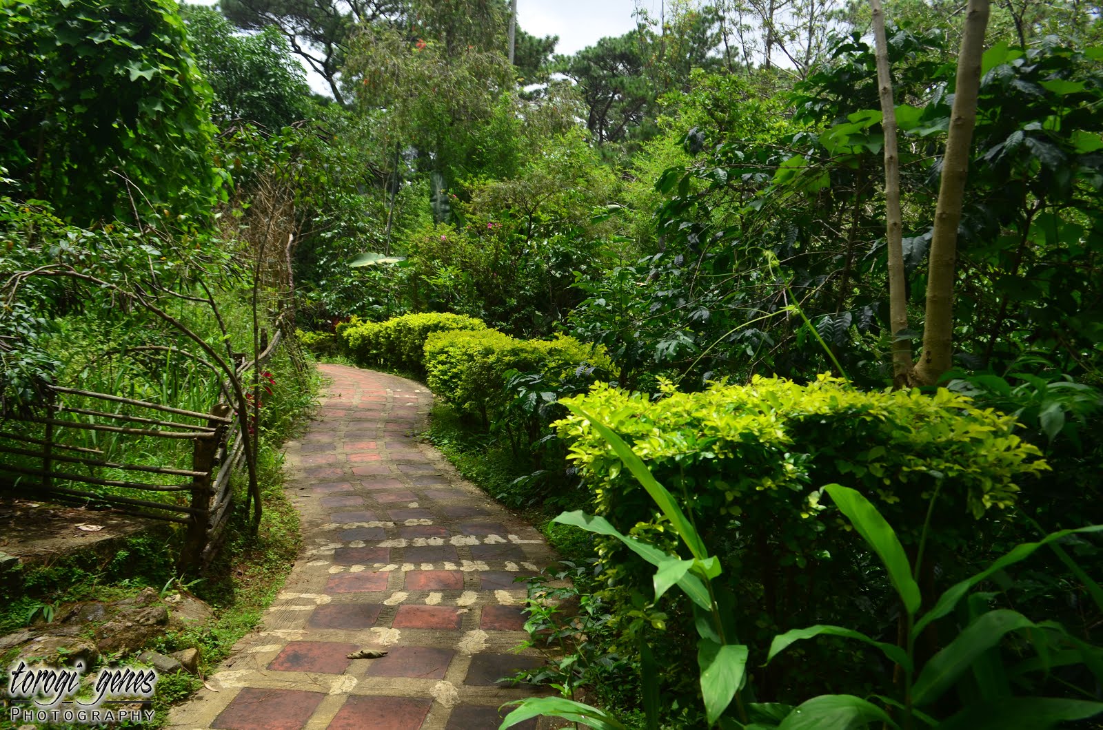
Concrete foot paths near the road.

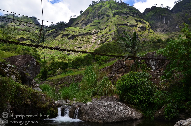
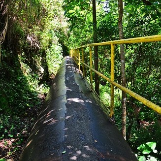
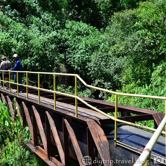
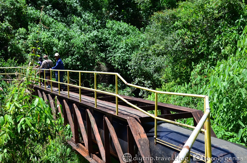
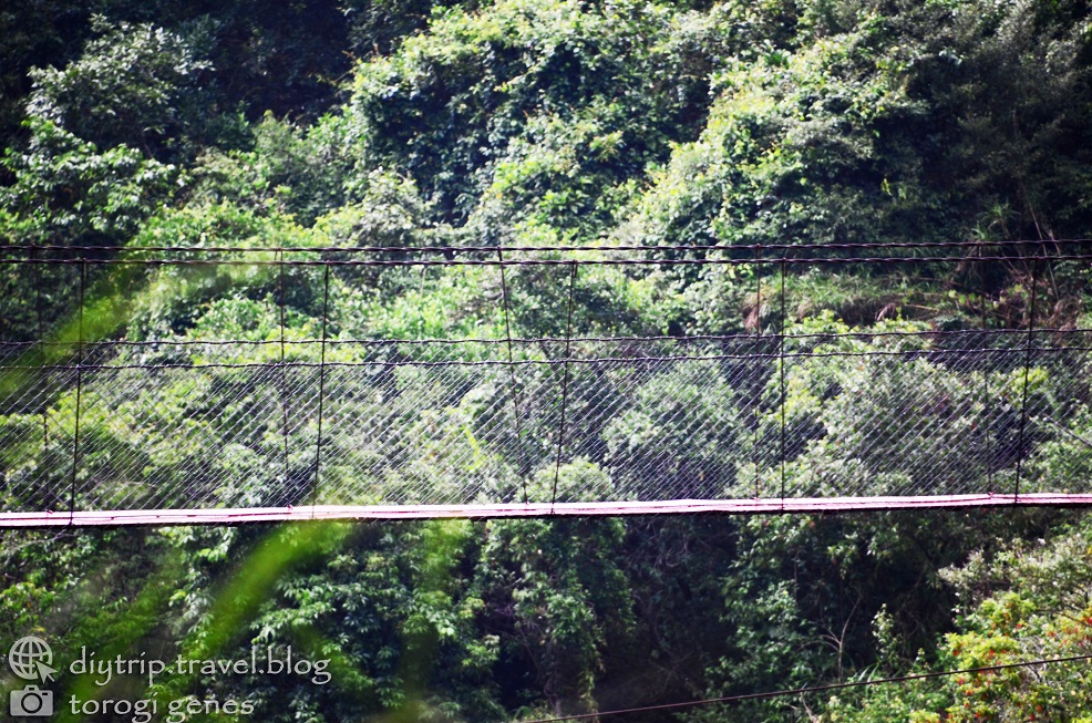
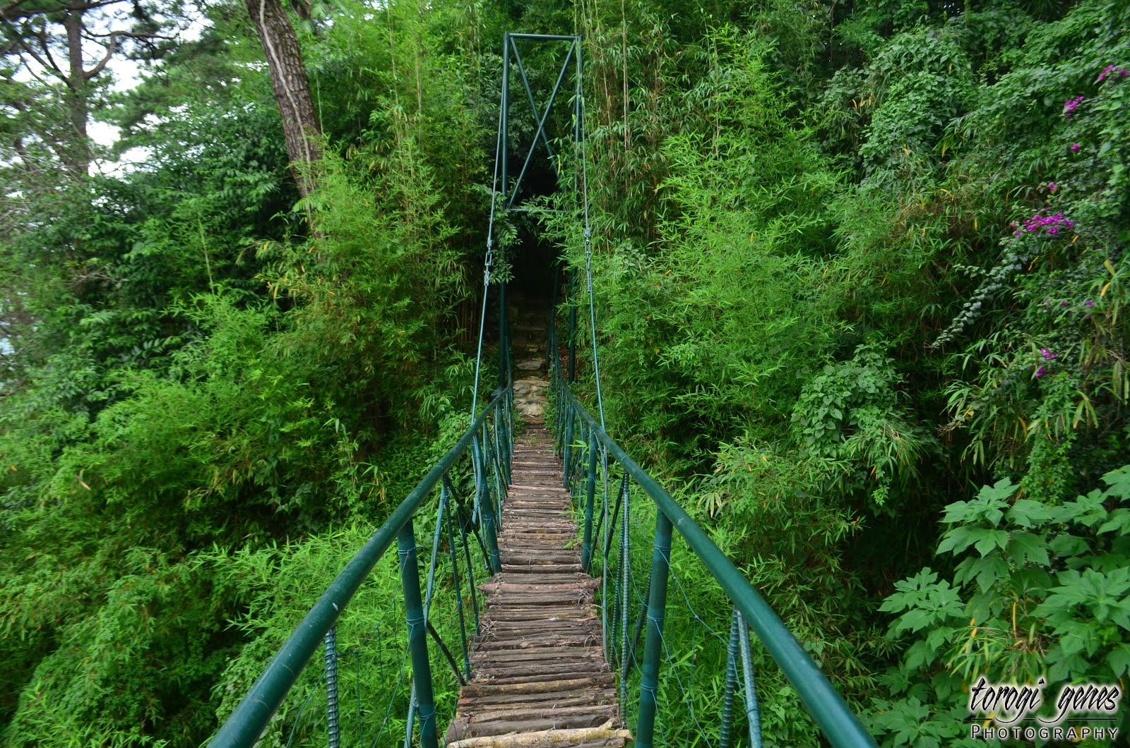
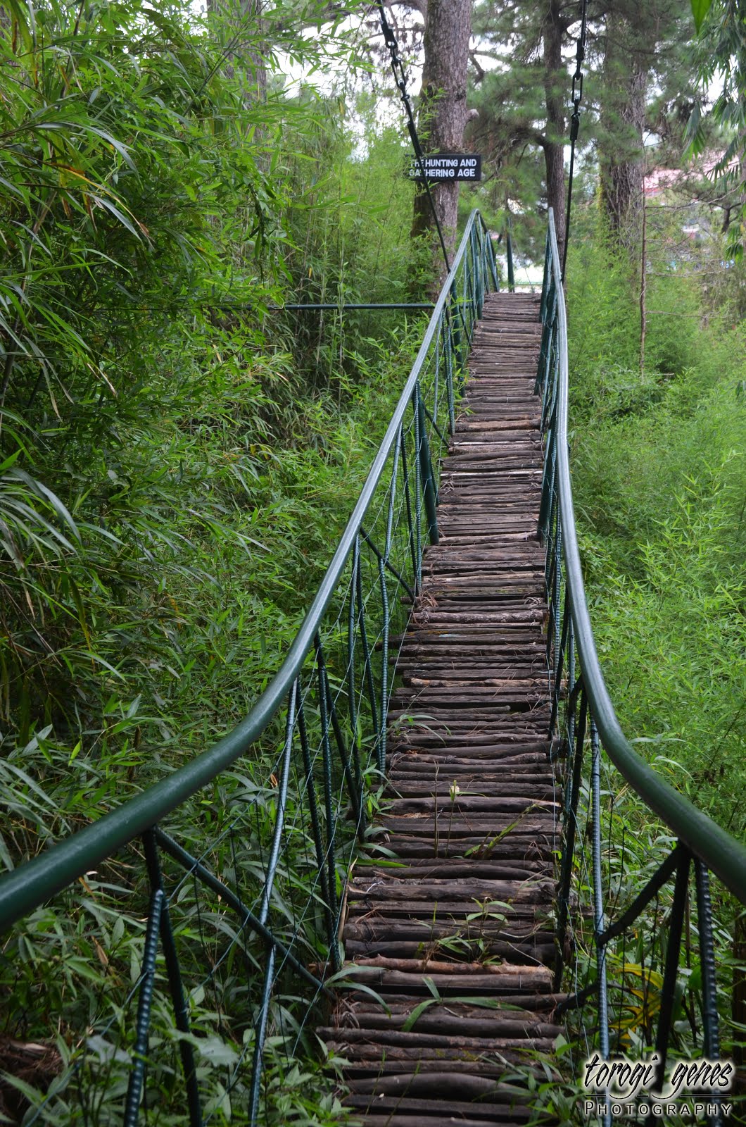
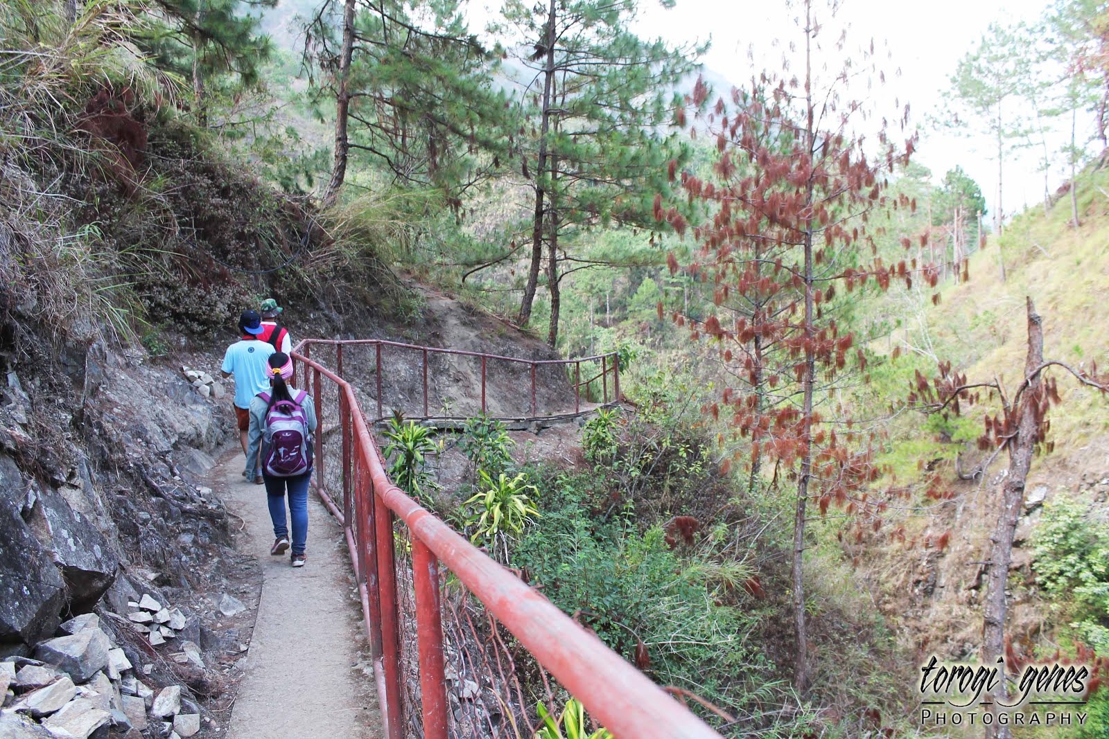
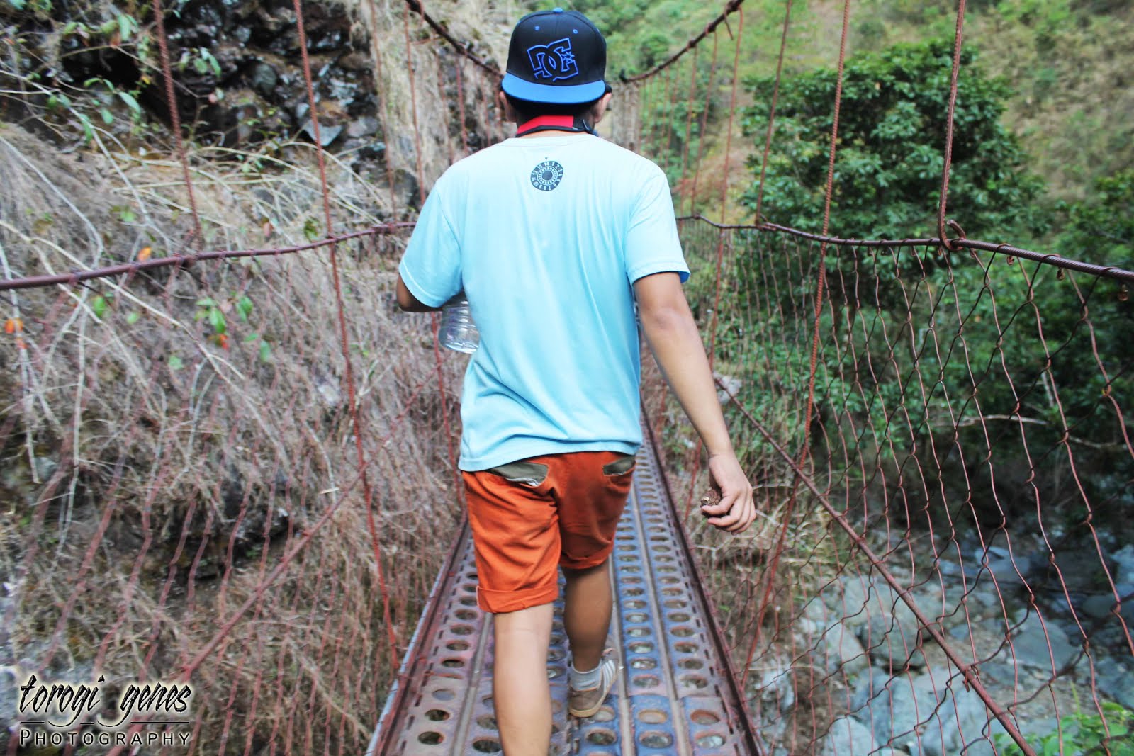
You will pass through a number of hanging bridges.

Mt. Kalugong

MT. KALUGONG ECO PARK

 
Location: La Trinidad, Benguet, Philippines
Google Map:
 
Coordinates: 16°27’37″N 120°35’44″E.
Major Jump-Off Areas: Cruz, La Trinidad, Benguet
Contact Details: 09196728888 or 09498980328
Entrance Fee: Php50.00
 
How to Get There: From Baguio City, take a jeepney bound to Tomay, Acop or Shilan. Drop at Benguet Memorial Services in Brgy. Cruz. The trail starts at the cemented road at the right side of this establishment.
 
Description
Of the mountains surrounding the salad bowl of the Philippines, Mt. Kalugong might be the most popular. There are three alluring reasons why this mountain is becoming more widely known. One, it offers a panoramic view of the whole valley and the pastureland and pine forests at the western portion of the municipality. Notable establishments seen from the mountain includes the whole stretch of Benguet State University, Benguet capitol building, La Trinidad municipal hall, strawberry fields, Bureau of Fisheries and Aquatic Resources fish ponds, and the Balili River snaking along three-kilometre stretch. Two, Mt. Kalugong offers a quiet place to relieve the stresses of the urban life. Currently, there are native huts, benches and tables, swing, and two ziplines erected in the conifer-covered area of the mountain. This environment is very pleasant to family or group picnics. Three, for the adventurous persons, Mt. Kalugong offers boulders upon boulders of limestones of different sizes and shapes.
 
The name of Mt. Kalugong came from a local word which means “hat”. This name is coined from a stone boulder resembling a baseball hat at the southern portion of the mountain as seen from the eastern part of the valley. Before the place was developed as an ecological park, the rock formations had been drawing a lot of locals. The area where it is not covered with limestone was previously used as venue for 4×4 off-road car racing.
 
Reminders
·         The Tabangaoen trail is already closed since 2014.
·         Practice the Leave-No-Trace (LNT) principle when visiting the place.
·         Do not vandalize the stone formations.
 
Gallery
 
The limestone formations have always been the biggest asset of the place.
 
 
Plants growing at the crevices near the ground.

At the top of the mountain, the panoramic view of the valley can be seen. However, in order to see this you need to move further west.

Buburtak weeds are all over the place. With that being said, bees are also present during the blossoming season.

If you are afraid of heights, this is not your place. Wear clothes suited for climbing rocks upon rocks.

Mt. Jumbo can be seen towards the southeast horizon.

Its as if the rocks were strategically planted on the ground.


Note the size of the rock to the brush.

Don’t wander on the limestone area at the heat of the day. It will be hard finding a shaded area.

Lichens cover some surfaces of the stones. Be wary of them to avoid slipping.

Mushrooms growing in a piece of wood wedged between stones.

This part reminds me of NatGeo shows. Its a perfect combination of rocks and greens.

 
Spot the dragon.

Check the following video of Nomadic Highlander for more details: