In 2016, I went to Abra to visit Kaparkan Falls and see the countryside as Ceenan, my lower batch in college, had suggested. To my utter amazement, I found that Abra is a beautiful place, with lots of potential for tourism.
My one week stay in Abra is productive yet insufficient because of the hassle of travelling from one municipality to another. I was not able to see Kaparkan Falls because there was a raging low pressure that time and no motorized bike would be hired because the road was almost impossible to pass because of continuous torrential rain. So I asked my guide-cum-driver if he could accompany me to Piwek Rock formation. Unfortunately, the water is so high that it is unsafe to continue the plan.
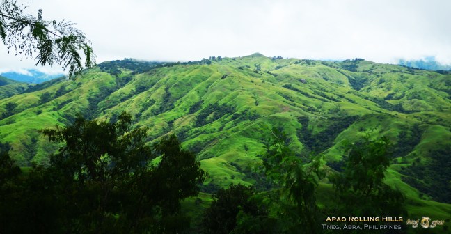
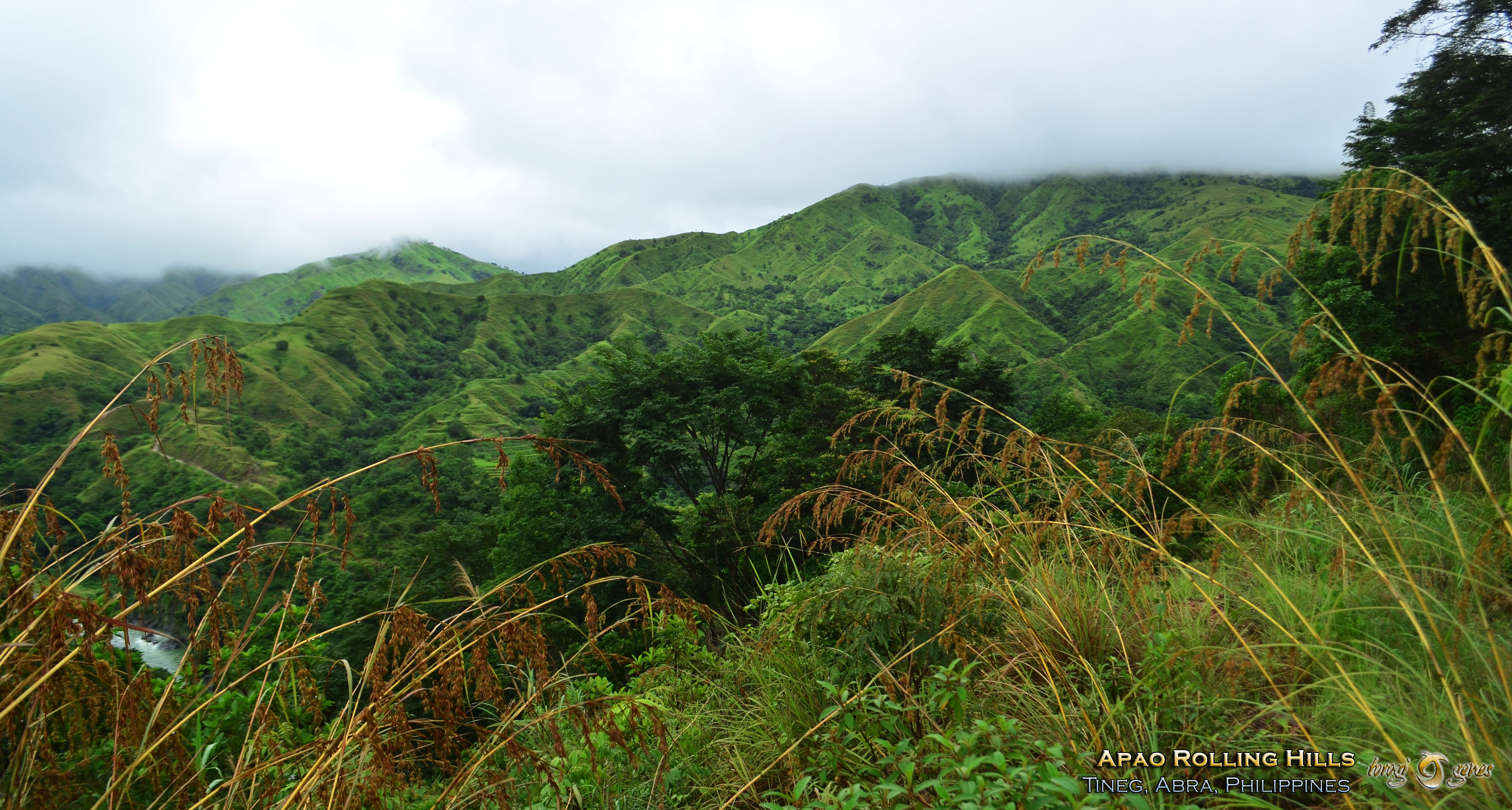
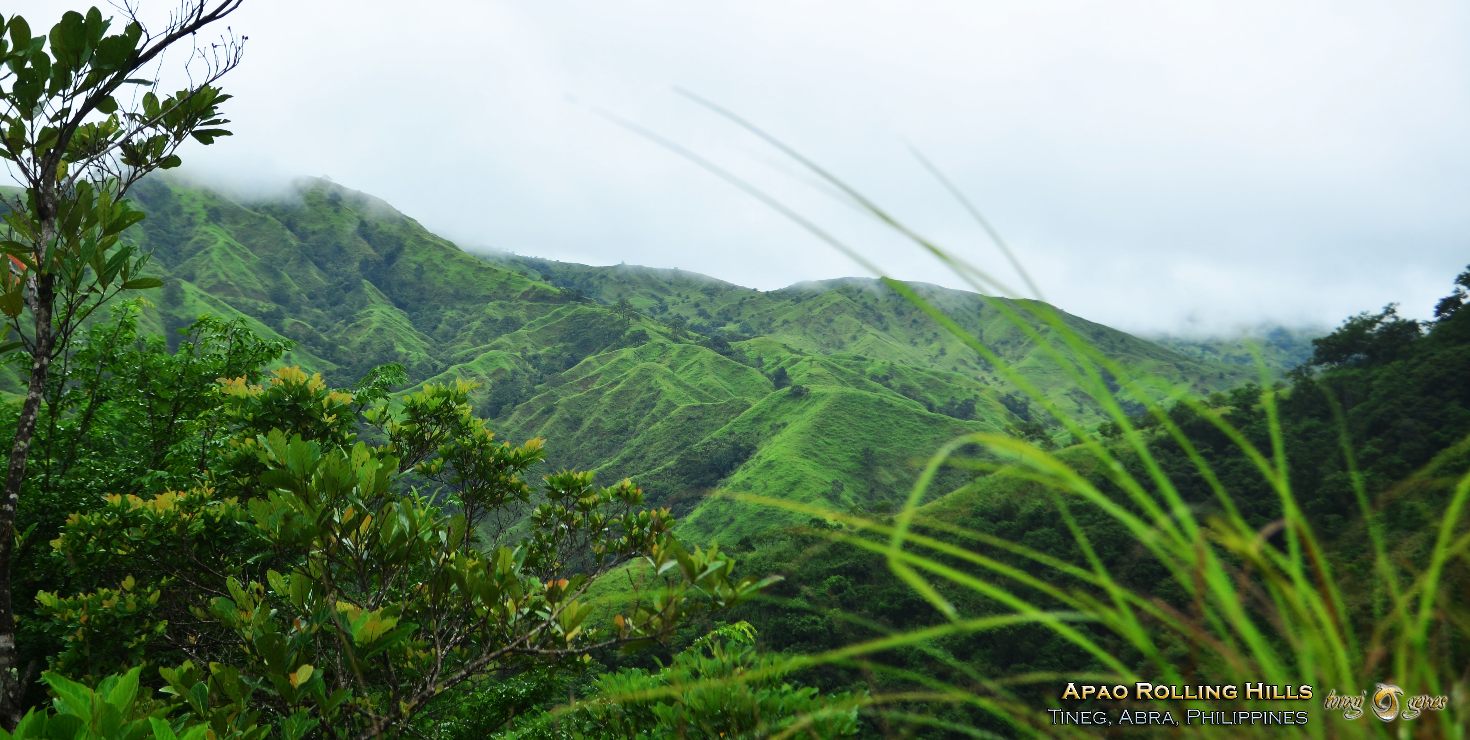
On our way to and from the river going to Piwek Rock formations, I saw verdant rolling hills and was awed by its beauty. The guide told me that it what we saw covers mostly Barangay Apao but also nearby barangays. I took some shots and I just named it Apao pastureland in my mind, because that is its main purpose. A year or two later, tourists called it Apao Rolling Hills, and it got stuck.
The hills near the municipal hall has actually a road on its base. I hoped then that it should not encroach the higher parts of the land as it will destroy the view.
Gallery
Embedded image below gives you the details of Apao Rolling Hills as seen in Google Map
When I went there in 2016, it was fortunate (though the swollen river stopped me from visiting Piwek Stone formations and Kaparkan Falls) that it is rainy season, thus the hills have that verdant green color. However, the fog has blanketed the mountains and hills that I cannot have a good view of the farther hills.

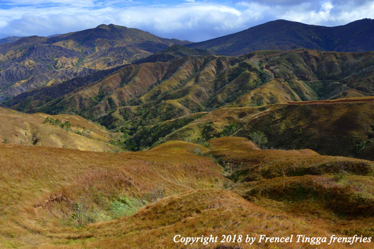
To give comparison of the place during summer time, the hills would look brownish with patches of green bushes. An example would be seen in the embedded image below from Fren Fries blog article (Tingga, 2018).
Other Notable Tourist Spots in Abra
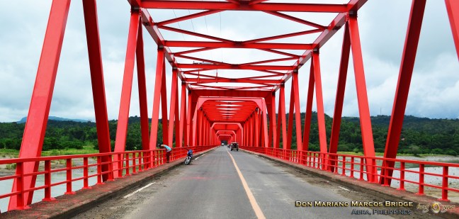
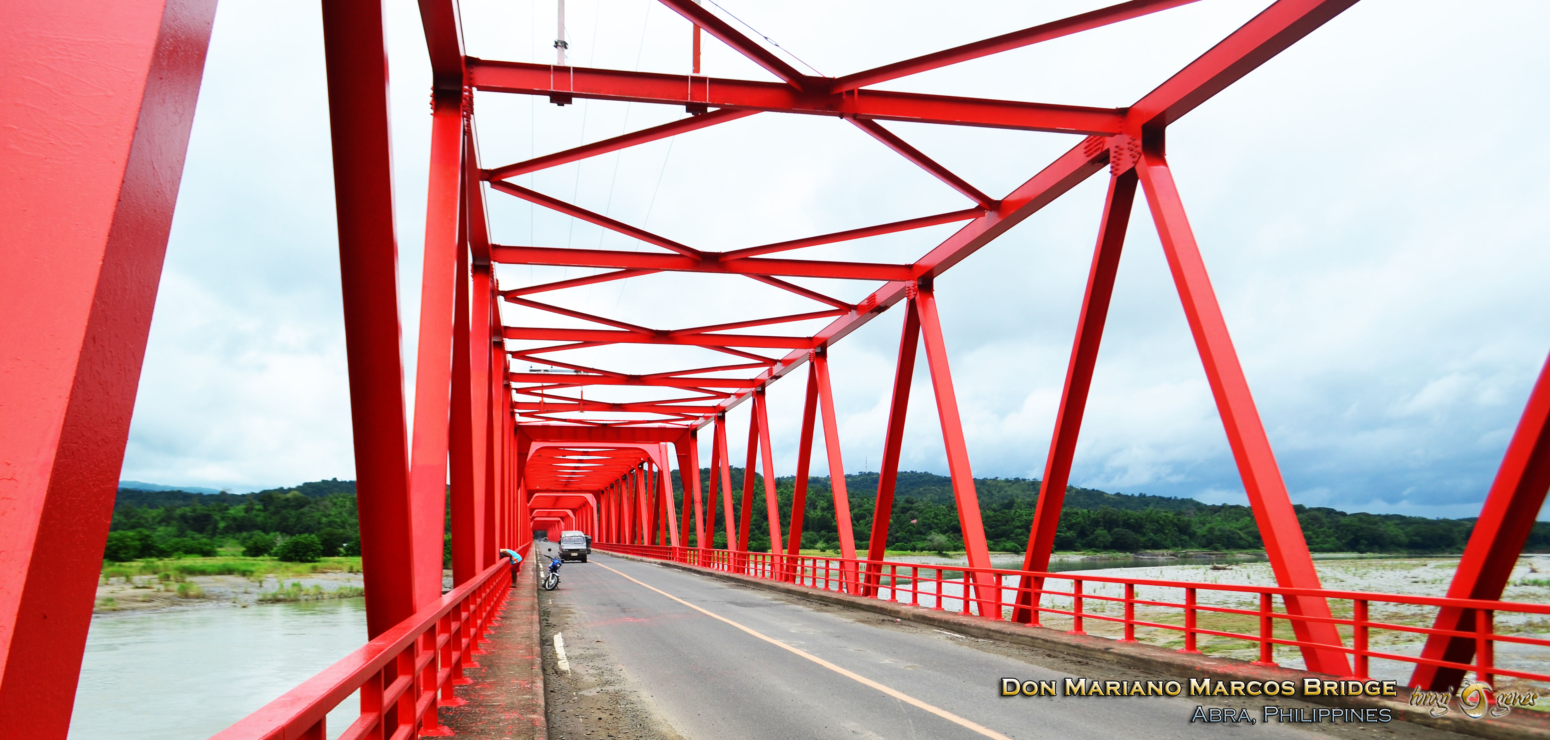
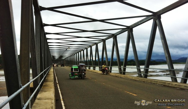
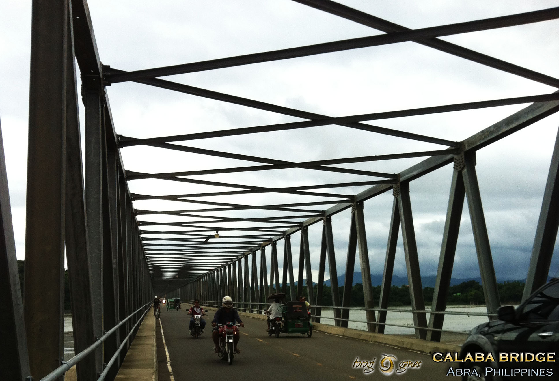
There are a lot of tourist destinations in Abra with Kaparkan Falls at the helm. Others include Kili Falls, Tayum Church, Cassamata Hill National Park, Tayum Church, Apao Rolling Hills, Sibud-Sibud Cave, Libtec Crystal Cave, Calaba Bridge, Don Mariano Marcos Bridge, Piwek Rock Formations, Tangadan Tunnel, and many more.
References
Tingga, F. (2018). Abra. Accessed on 27 June 2019 from Frenz Fries blog site https://loneprowler.com/wp-content/uploads/2019/06/30ec0-asc_003.jpg.